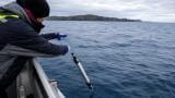
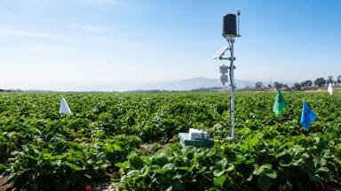
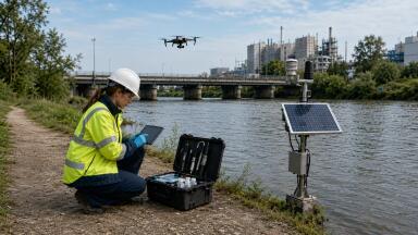
Portable & field testing
Selected in February 2026 for continued development under NASA’s Earth System Explorers programme, the mission would observe the three-dimensional structure of terrestrial ecosystems and the surface topography of glaciers, ice sheets and sea ice, extending the measurement heritage of earlier NASA missions including ICESat-2 and GEDI.
The launch date is no earlier than 2030, and the project must still pass confirmation review in 2027 but the mission concept points clearly toward the next phase of large-scale Earth observation: more structurally informative and better able to link local surveys with regional and global analysis.
For monitoring professionals in Asia, the relevance lies less in the Boise State participation highlighted in the university release than in the type of data EDGE is supposed to generate.
Many of the region’s most pressing environmental questions are not simply about presence or absence. They are about form, elevation, height, slope, roughness, canopy structure and surface change over time.
Whether the subject is glacier retreat in High Mountain Asia, mangrove condition in tropical coasts, or wildfire risk in dry landscapes, the monitoring challenge is often three-dimensional.
EDGE is being designed to address exactly that problem, producing a next-generation global baseline elevation map and improving on the current generation of spaceborne laser altimetry.
The mission team says it would dramatically increase surface sampling compared with ICESat-2 by using 40 laser beams rather than six.
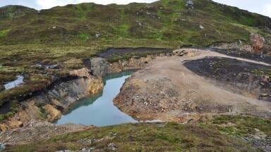
The cryosphere is the clearest Asian use case. Glacier change in the Hindu Kush Himalaya is not a niche scientific issue but a major monitoring problem with direct implications for water resources, hazards and long-term regional stability.
In March 2026, ICIMOD reported that glaciers in the Hindu Kush Himalaya are losing ice at roughly double the rate seen before 2000.
Just as importantly for the monitoring community, it also highlighted a significant data shortfall: of the 38 glaciers included in its latest synthesis, only seven met the benchmark monitoring standard used by the World Glacier Monitoring Service.
In a region with more than 63,000 glaciers and major river systems supporting around two billion people, better and more consistent elevation data is not a luxury. It is part of the basic information infrastructure needed to track change properly.
A mission such as EDGE would not solve all of those gaps but it could improve the spatial consistency and structural detail of glacier and ice-surface observations across a region where field access is limited and conditions are changing rapidly.
There is also a strong coastal and ecosystem-monitoring angle. Across Asia, environmental professionals are dealing with overlapping pressures from sea-level rise, coastal erosion, sediment shifts, storm damage, salinity intrusion and wetland degradation.
In these settings, conventional satellite products can show where change is happening, but they are often less effective at capturing the full structural state of vegetation and landform.
That matters particularly for mangroves and other coastal ecosystems, where monitoring priorities increasingly include biomass, species composition, canopy structure and resilience, not just area.
Recent remote-sensing research on mangroves has stressed the need for approaches that can better distinguish structural condition and degradation, especially in tropical and subtropical regions.
More detailed surface elevation and vegetation-structure data from a future mission such as EDGE could therefore become a useful complement to the optical, radar and field datasets already used in coastal monitoring programmes across Asia.
The mission may also have value for fire, land and catchment monitoring. In the Boise State release, researchers point to a familiar problem in remote sensing: low-height vegetation and steep slopes are hard to characterise accurately, yet they are highly relevant for practical work including fire-risk assessment and post-fire analysis.
That argument translates well to parts of Asia where shrublands, dry forests, degraded uplands and complex terrain complicate observation. Monitoring teams may be able to collect excellent drone or ground-based LiDAR data for specific sites, but scaling those observations up remains difficult.
This is one of the more interesting aspects of EDGE. It promises not simply more data from space, but data that may help bridge the gap between fine-scale surveys and broader satellite products. For professionals working on watershed risk, erosion, wildfire, habitat condition or carbon assessment, that bridging function may prove more important than any single headline application.
The timing, however, matters. EDGE is not an operational monitoring asset today. It is a mission concept that has been selected for further development, with budget and progress still subject to NASA review.
That means the story should not be oversold as an immediate solution for Asian monitoring agencies or environmental service providers. The more accurate reading is that it offers a glimpse of the observational capabilities likely to shape the next decade of remote monitoring.
For readers in Asia, that makes it a strategic rather than immediate story: less about what they can buy or deploy now, and more about the kinds of datasets they may need to prepare for, integrate with, or build workflows around later this decade.
That is still significant. Monitoring professionals are increasingly expected to work across scales, linking field instruments, drone surveys, institutional repositories, modelling systems and satellite platforms into coherent evidence chains. Missions such as EDGE matter because they can alter what is possible at the regional layer of that stack.
In Asia, where terrain is often difficult, ecosystems are diverse, and climate impacts are intensifying, more detailed 3D Earth observation could support better interpretation of changes in glaciers, coasts, forests and water-linked landscapes. The Boise State angle may be local. The monitoring implications are not.
IET 36.3 May