Air monitoring
For years, sustainability reporting often sat at a distance from the hard edge of environmental monitoring. Companies made broad claims, published high-level metrics, and assembled glossy maps or summary charts to show they were taking environmental risk seriously. What they did not always provide was evidence that was spatially precise, independently verifiable, and robust enough to stand up to regulatory or audit scrutiny.
That is beginning to change.
A new review in Big Earth Data argues that geospatial data and workflows are becoming increasingly important in environmental compliance reporting, particularly as European regulation becomes more demanding. For environmental monitoring professionals, that matters because it points to a world in which satellite data, GIS, and Earth observation are no longer peripheral decision-support tools, but part of the evidence chain behind environmental claims.
This is not just an ESG reporting story. It is a story about how compliance is becoming more spatial, more traceable, and more dependent on data that can link environmental impacts to specific places, assets, and time periods.
The shift is being driven by regulation. Over the last decade, sustainability reporting has moved from a largely voluntary exercise to a more formalised compliance requirement, particularly in the EU. Frameworks such as the Corporate Sustainability Reporting Directive, the European Sustainability Reporting Standards, the EU Taxonomy, the Sustainable Finance Disclosure Regulation, and the EU Deforestation Regulation are all increasing the pressure on companies to disclose environmental information in a way that is more detailed, consistent, and verifiable.
The problem, as the review sees it, is that corporate reporting methods have not always kept pace. Many disclosures still rely on aggregated indicators, self-reporting, or environmental data that may be difficult for auditors, regulators, or third parties to test independently.
That is where geospatial workflows come in. By combining GIS, satellite imagery, Earth observation products, and structured analytical methods, organisations can move closer to showing not just that an environmental risk exists but where it occurs, how it relates to a specific operation or supply chain and whether a claim holds up when checked against external evidence.
For monitoring professionals, this is familiar territory in a new setting. The core issue is no different from any other compliance challenge: what counts as acceptable evidence, how reliable it is and whether it is fit for purpose.
The review identifies three broad families of geospatial workflow: risk screening, attribution, and verification. These may sound abstract, but they map quite neatly onto the practical logic of environmental monitoring.
Risk screening is the first layer. It uses land cover products, forest-loss maps, near-real-time alerts, and similar datasets to flag geographies, facilities, suppliers, or assets that may be exposed to environmental risk. In a water context, that could mean identifying catchments vulnerable to runoff, sediment loading, nutrient pressure, or upstream land-use change. In soil monitoring, it could help flag erosion, degradation, vegetation loss, or land conversion. In air monitoring, spatial screening can support the identification of industrial clusters, land-use conflicts, transport-related pressure zones, or locations where emissions risk is likely to be elevated.
Attribution is more demanding. It is not enough to detect environmental change in a broad area; the question is whether that change can be linked to a particular source, site, operator, farm, facility, or value-chain segment. This is where compliance reporting starts to become much more consequential. If deforestation, land disturbance, runoff risk, or pollution can be tied to a specific asset footprint, then environmental reporting becomes harder to blur into general corporate narrative.
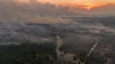
Verification is the most obviously regulatory of the three. Here, geospatial evidence is used to test a company’s claims independently. The paper gives the example of confirming that a deforestation-free coffee supply chain does not overlap with forest loss after the EU’s cut-off date under the EUDR. But the broader principle extends well beyond deforestation. It points toward a future in which environmental claims increasingly need to be checked against independently generated spatial evidence.
For monitoring readers, the important point is that these workflows are not substitutes for field monitoring, sampling, or instrumentation. They are additional evidential layers that can strengthen, challenge, or contextualise what site-level monitoring already shows.
Some parts of the environmental monitoring sector will see themselves in this story more immediately than others. Water and land professionals may feel closest to it, because catchment dynamics, land-use change, soil condition, and hydrological risk are already deeply spatial issues. But the relevance is wider than that.
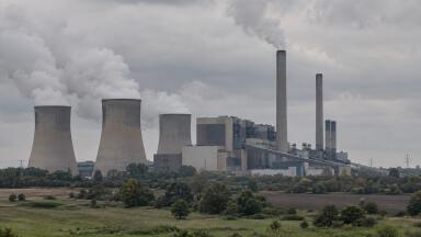
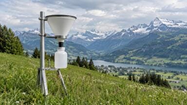
Air monitoring, for example, depends heavily on geography even when the measurements themselves come from fixed or mobile instruments. Source proximity, land use, terrain, meteorology, infrastructure, and settlement patterns all affect how air pollution is generated, transported, and experienced. Geospatial data can therefore become increasingly important in framing compliance cases, source attribution, emissions accountability, and risk communication.
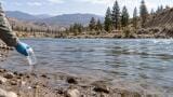
For water monitoring, the fit is more obvious still. Catchment-based pollution, agricultural runoff, sediment transport, water-resource pressure, habitat change, and supply-chain-linked water risks all have strong spatial dimensions. Geospatial analysis can help determine where monitoring effort should be focused, where impacts are likely to emerge, and whether reported improvements or protections are visible in landscape-scale evidence.
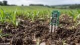
Soil monitoring also stands to gain from the increased use of geospatial workflows, particularly where compliance frameworks begin to care more about land stewardship, erosion, land conversion, ecological restoration, or supply-chain-linked environmental impacts. Here too, the point is not that satellites can replace direct measurement, but that compliance reporting increasingly wants evidence that can connect local condition to wider land-system change.
One of the strongest parts of the review is its rejection of what might be called decorative GIS. Too often, maps appear in sustainability reports as visual reassurance rather than auditable evidence. They imply rigour without necessarily demonstrating it.
The authors argue that geospatial layers should instead be treated as formal reporting inputs, with documented provenance, versioning, lineage, and uncertainty. They point to established geospatial quality concepts such as completeness, positional accuracy, temporal accuracy, and thematic accuracy, and suggest that metadata practices such as ISO 19115-style documentation are essential if these datasets are to be trusted in compliance settings.
That should resonate strongly with environmental monitoring professionals. Instrument readings are not considered meaningful in isolation; they come with calibration records, quality controls, method statements, and known limitations. The paper’s central demand is, in effect, that geospatial evidence be held to a similar standard.
That is good news for serious practitioners. It raises the bar, but it also makes room for workflows that are transparent, technically defensible, and less vulnerable to greenwashing.
The review also touches on GeoAI, the fast-growing combination of artificial intelligence with Earth observation and geospatial analysis. This is one of the most interesting parts of the story because it points to where compliance reporting may be heading next.
AI-assisted mapping could make it easier to classify land cover, identify change, characterise forest structure, track land-use dynamics, or detect patterns at scale. That has obvious appeal for regulators, companies, and service providers trying to manage increasingly complex reporting obligations.
But the paper is careful not to overstate the case. Many GeoAI systems still lack the transparency, benchmarking, and uncertainty disclosure needed for regulated applications. For environmental monitoring audiences, that is a very familiar tension. A tool may be analytically powerful without yet being compliance-ready. If a model cannot clearly explain its training data, performance limits, or failure modes, it may struggle to function as trusted evidence in an audit or reporting context.
In other words, the future may well be GeoAI-enabled, but not every GeoAI output is automatically fit for regulation.
What makes this paper worth covering for your audience is that it captures a broader shift in environmental governance. Monitoring is no longer just about collecting readings from instruments, samples, or field surveys and placing them in a report. It is about fitting those readings into a wider evidential system that includes geospatial context, remote sensing, workflow transparency, and external verification.
That has practical implications for air, water, and soil professionals. Monitoring data may increasingly need to interoperate with satellite-derived layers, GIS platforms, supply-chain mapping systems, and audit-ready documentation structures. The organisations that do this well will not just generate data; they will be able to show how that data fits into a credible chain of environmental accountability.
The real takeaway is simple. Environmental compliance reporting is becoming less about what companies say, and more about what can be shown. Geospatial data is emerging as one of the tools that can help show it.
IET 36.5 Sept/Oct 2026



 Product directory