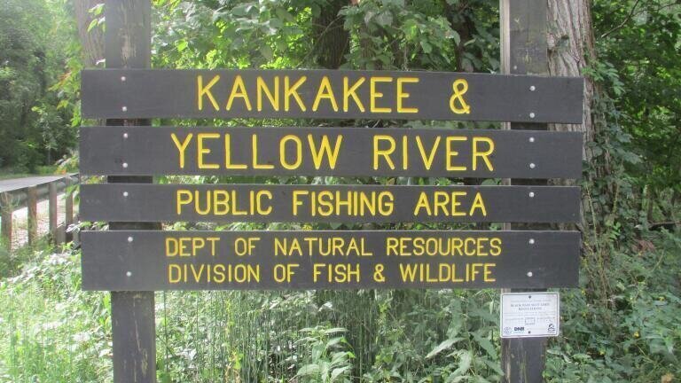
River water monitoring
By combining Landsat imagery with a retrieval model designed for extremely turbid waters, researchers have mapped sediment dynamics across the river from 1986 to 2023, showing both a long-term decline and a more recent break in that trend.
For environmental monitoring professionals, the main significance is not simply that the Yellow River has become less sediment-laden overall. It is that a major river system once monitored mainly through scattered hydrological stations can now be assessed continuously across space and time. That changes what sediment monitoring can do.
Suspended sediment concentration is a core water quality and river management parameter. It shapes channel morphology, affects reservoir performance, influences flood risk and has major consequences for aquatic habitats and downstream sediment delivery. In the Yellow River, it is especially important because sediment has historically defined the river’s behaviour, particularly after it passes through the Loess Plateau.
Conventional station data has long shown that sediment loads have fallen in recent decades. But station networks, however valuable, only capture fixed points. They do not easily show how sediment changes between reservoirs, around tributary junctions or across long river reaches. That matters in a basin where engineering works, erosion control and ecological restoration are all reshaping sediment transport in different ways.
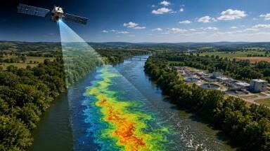
This study addresses that gap by using more than 12,000 cloud-filtered Landsat scenes to reconstruct suspended sediment concentration along the full river system. The result is a much more spatially detailed record of how sediment patterns have evolved over nearly four decades.
The broad pattern is that sediment concentration generally rises from the upper reaches to the estuary, but not smoothly. There are sharp drops near major reservoirs, where sediment is trapped, and marked increases where sediment-rich tributaries enter the main stem. In other words, the river’s turbidity is not a simple downstream gradient. It is heavily structured by infrastructure and landscape processes.
The temporal picture is equally important. The researchers identified three phases: rising sediment from 1986 to 1997, a strong decline from 1997 to 2016, and a more variable period after 2016. That last phase is particularly significant because it suggests the long downward trend has weakened or shifted. For monitoring professionals, that is the kind of regime change that matters most. It signals that past assumptions may no longer hold and that management frameworks based on steady decline may need revision.
The study attributes most of the interannual variation to human activity rather than weather alone. Reservoir trapping had the largest influence, followed by vegetation recovery and check dams. Together, these outweighed the effects of precipitation, wind speed and runoff. That finding reinforces a wider point relevant to river monitoring globally: sediment is increasingly governed by engineered and managed systems, not just by natural hydrology.
A major technical challenge in the Yellow River is its unusually wide sediment range. Standard remote sensing approaches often struggle in waters that are extremely turbid, because spectral responses can behave differently across concentration ranges. To address this, the research team developed a piecewise retrieval algorithm using red, green and near-infrared bands, calibrated with field samples and then extended across multiple Landsat sensors.
That matters because it shows how remote sensing can be adapted to difficult monitoring environments rather than being limited to clearer water systems. For practitioners, this is one of the most useful parts of the study. It demonstrates that long-term satellite archives can be turned into operationally meaningful sediment records, provided the retrieval model is sufficiently tuned to local conditions and sensor differences.
More broadly, it points to an increasingly important monitoring model: field sampling for calibration, Earth observation for coverage, and statistical analysis for long-term trend detection. None of those elements is enough on its own. Together, they create a scalable way to monitor systems that are too large or too dynamic for conventional networks alone.
The Yellow River is one of the clearest examples of a basin where sediment management, water regulation and ecological policy are tightly intertwined. Reservoirs trap sediment, which can reduce downstream turbidity but also alter channel processes and sediment delivery. Vegetation restoration can stabilise soil and cut erosion, but it may also change runoff dynamics. Check dams reduce sediment transport locally while accumulating material within managed landscapes.
What this study offers is a way to observe how those interventions add up at basin scale. That has clear implications for reservoir operators, catchment managers and regulators. If satellite-based sediment monitoring can identify where turbidity drops, where it rebounds and when long-term trends begin to shift, then it can support more adaptive decisions about sediment flushing, erosion control priorities and restoration strategies.
It also strengthens the case for integrating sediment into broader environmental intelligence systems. In many basins, sediment is still treated as a specialist hydrological issue rather than a central environmental indicator. But sediment sits at the intersection of water quality, land use, habitat condition, infrastructure performance and climate resilience. A monitoring framework that captures it well can support multiple policy areas at once.
Although the Yellow River is an extreme case, the wider implications extend to other highly turbid or heavily managed river systems. Many monitoring networks still depend on sparse stations, periodic sampling and fragmented datasets. That makes it difficult to see long-term spatial change, especially where dams, tributary inputs and restoration programmes alter river behaviour unevenly.
This study shows that satellite archives can help fill that gap. More importantly, they can reveal turning points that station-based approaches may miss or detect too late. For environmental monitoring professionals, that is the broader lesson. The future of river observation is likely to depend less on choosing between field and satellite methods, and more on combining them into systems that can detect structural change across whole basins.
In that sense, the Yellow River work is not just a regional case study. It is an example of how sediment monitoring is evolving from point measurement to basin-scale intelligence. For a sector increasingly concerned with forecasting, resilience and intervention effectiveness, that is a meaningful shift.
IET 36.5 Sept/Oct 2026


 Product directory
















.jpg)