.jpg)
.jpg)
.jpg)
River water monitoring
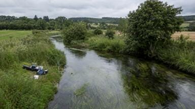
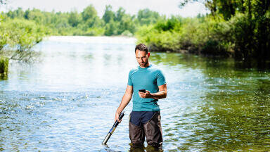
Measuring dynamic rivers and streams is inherently challenging because these systems are unsteady, spatially complex, and constantly changing. Unlike controlled laboratory channels, natural rivers respond continuously to variations in water, sediment, and energy inputs driven by rainfall, snowmelt, land-use change, and human intervention. These fluctuations make it difficult to obtain accurate and representative measurements of discharge, sediment transport, channel form, and water quality, requiring careful methods and acceptance of uncertainty.
A key difficulty is measuring discharge, the volume of water flowing through a channel per unit time. Discharge depends on flow velocity and cross-sectional area, both of which vary significantly, especially during storm events. Rising water levels can alter channel geometry, submerge floodplains, and change flow distribution. Velocity is uneven across the channel, influenced by friction, turbulence, obstructions, and channel shape. Instruments such as current meters and Acoustic Doppler devices attempt to capture this variability, but high turbulence and debris during floods often reduce accuracy. Many gauging stations rely on rating curves that relate water level to discharge, yet these assume stable channel geometry. Erosion and deposition frequently alter cross-sections, requiring recalibration and introducing systematic errors.
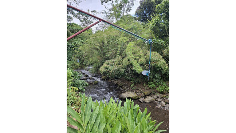
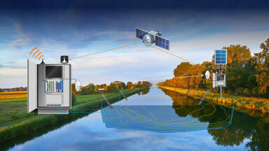
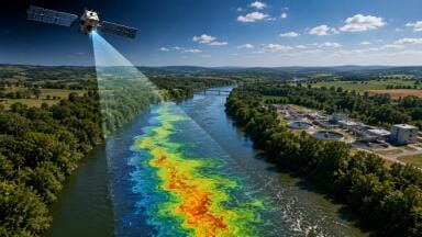
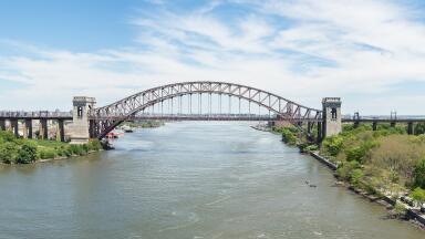
Non-contact radar systems offer clear advantages, particularly during floods. Mounted on bridges or elevated platforms, these sensors measure surface velocity or water level remotely using electromagnetic waves. This approach improves safety by eliminating the need for field personnel to enter hazardous floodwaters and reduces the risk of equipment damage from debris. Radar systems remain operational during extreme events, capturing peak discharge more reliably than submerged instruments, which often fail under such conditions. They also require less maintenance, as they are not subject to corrosion, biofouling, or mechanical wear, resulting in more continuous datasets and lower long-term costs. Additionally, radar systems provide high temporal resolution, enabling detailed monitoring of rapidly changing flows and supporting real-time forecasting and warning systems.
Using drones equipped with non-contact radar further enhances measurement capabilities. Drones allow rapid deployment and flexible data collection across multiple locations, which is especially useful for capturing short-lived peak flows. They can access areas where fixed infrastructure is unavailable or damaged and provide broader spatial coverage by surveying extended river reaches, braided channels, and floodplains. This improves understanding of flow distribution during extreme events and supports emergency response and flood modeling.
Sediment transport presents another major challenge. Rivers carry both suspended sediment and bedload, with most transport occurring during short, high-magnitude events that are difficult and dangerous to measure. Bedload samplers may miss coarse material or spatial variability, while suspended sediment concentrations vary rapidly with depth and time. Instruments can clog or be damaged, and small measurement errors can lead to large uncertainties because sediment transport is highly nonlinear.
Channel morphology adds further complexity. Rivers migrate, erode, and deposit sediment, forming features such as bars and riffles. Braided and meandering systems shift over time, making it difficult to maintain consistent measurement locations. Even minor changes in bed elevation can significantly affect flow patterns, requiring frequent recalibration of monitoring systems.
Temporal variability also complicates measurement. Processes such as flash floods and daily water quality cycles occur over short timescales and are often missed by manual sampling. Automated sensors improve resolution but introduce issues like drift, fouling, and data gaps during extreme conditions. Human activities, including dams and urbanization, further alter flow regimes, creating nonstationary conditions that challenge traditional methods.
Ultimately, uncertainty is unavoidable. Measurement errors propagate through calculations, and scaling local observations to larger systems requires assumptions. Because rivers are nonlinear and sensitive to change, even small inaccuracies can significantly affect predictions, making a combination of field data, modeling, and statistical analysis essential.
IET 36.5 Sept/Oct 2026

 Product directory








.jpg)
.jpg)
.jpg)