River water monitoring
Many are remote, variable or intermittent. Some small streams are difficult to define at all, particularly where channels run dry for part of the year.
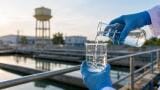
Yet these same river systems can carry the nutrients, sediments and pollutants that affect downstream drinking water treatment, ecological health and public safety.
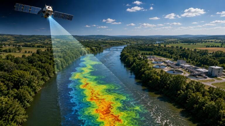
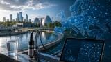
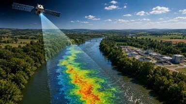
A new review in Nature Water, led by researchers including University of Cincinnati environmental engineering professor Dongmei Feng and Southern Methodist University’s Xiao Yang, argues that satellite remote sensing could become a central tool in a new global river science.
For environmental monitoring professionals, the significance lies in how satellite data could be used alongside existing monitoring networks.
Rather than relying only on fixed sampling points, periodic grab samples or local sensor deployments, water managers could increasingly use satellite observations to detect broader patterns in river condition.
These could include changes in turbidity, sediment movement, river width, inundation, algal growth and other indicators linked to water quality risk.
That matters because many pollution events are spatially uneven and time-sensitive.
A harmful algal bloom does not appear everywhere at once. Nutrient loads from sewage, agricultural fertiliser or storm runoff move through catchments in pulses.
By the time a bloom becomes visible at an intake, the operational challenge for a drinking water treatment plant may already be serious.

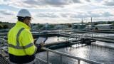
The drinking water concern is especially clear in relation to harmful algal blooms.
When excess nitrogen and phosphorus enter rivers, they can support rapid algal growth. Some blooms contain toxic cyanobacteria, which can create risks for human health, aquatic ecosystems and recreational water users. They can also force treatment plants into more complex and expensive treatment processes.
Blooms can block sunlight, damage aquatic plants and contribute to oxygen depletion when algae die and decompose. In severe cases, this process can produce dead zones and fish kills.
For utilities, regulators and laboratories, the challenge is not only confirming that a bloom is present. It is detecting the conditions that make one likely.
This is where remote sensing is becoming more relevant. Satellites can monitor reflected light from water surfaces. Changes in the spectral signal can indicate shifts in water colour, suspended matter, chlorophyll-related signals and other observable features. Combined with modelling and field data, these observations could help researchers identify nutrient dynamics and bloom risk over much larger areas than would be possible through field sampling alone.
Feng’s work is expected to examine decades of global river data to better understand how rivers carry nutrients and how that knowledge could support early warning systems for toxic algal blooms.
Why this does not replace field monitoring
For the monitoring sector, the practical message is simple: satellites are a screening layer, not a complete measurement system.
Satellite data can show where conditions are changing, where bloom risk may be increasing, or where a river is behaving differently from its historical pattern. But drinking water decisions still require defensible local evidence.
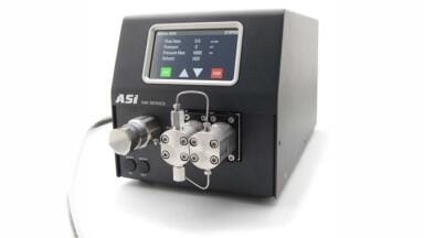
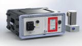
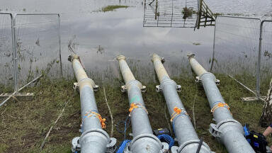
That means in-situ sensors, autosamplers, laboratory nutrient analysis, cyanotoxin testing, telemetry, QA/QC procedures and field validation remain essential.
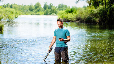
A satellite may help identify a hotspot. A monitoring team still has to confirm what is happening in the water column, what substances are present, whether toxins are being produced, and whether treatment processes need to change.
This creates a stronger case for integrated monitoring networks.
In practice, a future river monitoring workflow could begin with satellite observations and catchment models, move into targeted field sampling, and then feed into laboratory analysis, treatment plant decision-making and public health communication.
For suppliers, this points towards growing demand for instruments and services that can connect with wider data systems.
The growth of satellite-based river monitoring could make laboratory and field measurements more important, not less.
Remote sensing algorithms need calibration and validation. They rely on reliable ground-truth data from rivers with different depths, colours, sediment loads, flow conditions and surrounding land uses. Without that field evidence, satellite signals can be difficult to interpret.
This gives monitoring professionals a central role in making satellite data operational.
Laboratories may be asked to provide reference nutrient measurements, chlorophyll analysis, toxin testing and method validation. Field teams may be asked to collect samples at specific times when satellite data suggests a change in river condition.
Sensor suppliers may find opportunities in continuous nutrient monitoring, fluorescence-based systems, turbidity sensors, dissolved oxygen probes and telemetry platforms that can support early warning models.
The strongest systems are likely to combine multiple forms of evidence.
A satellite image may suggest elevated bloom risk. An upstream nutrient sensor may show a recent load increase. An autosampler may capture a storm-related pulse. Laboratory analysis may confirm phosphorus, nitrogen or cyanotoxin concentrations. Together, those data streams can support a more defensible assessment than any single method alone.
One important point from the research is that rivers cannot be treated as identical systems.
Each river reflects its own climate, geology, land use, hydrology, infrastructure and human pressures. A signal that indicates one type of risk in one catchment may mean something different in another.
That is especially relevant for intermittent streams, highly turbid rivers, shallow channels and heavily modified urban rivers.
For monitoring professionals, this reinforces the need for local calibration and contextual interpretation. Satellite data may provide global coverage, but the decisions that follow are still local.
Water companies, regulators and catchment managers will need to understand how satellite-derived indicators relate to their own river systems, treatment risks, sampling plans and compliance obligations.
The real value of satellite river monitoring may be earlier intervention.
If nutrient dynamics can be tracked more effectively, water utilities may be able to prepare treatment processes before bloom conditions become acute.
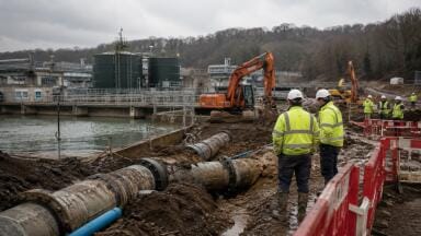
Regulators may be able to identify catchments where sewage or agricultural nutrient pressures are increasing. Catchment managers may be able to prioritise inspections, mitigation measures or restoration work.
This could also support better communication between drinking water operators, environmental regulators, wastewater utilities and agricultural authorities.
Harmful algal blooms are not only a treatment plant problem. They are a catchment problem. They reflect what is entering rivers, how nutrients move, and how environmental conditions convert those nutrients into biological risk.

For the environmental monitoring sector, the emerging message is that river protection is becoming a data integration challenge.
Satellite remote sensing can widen the field of view. Field sensors can provide continuous local evidence. Laboratories can confirm what the signal means. Models can connect conditions upstream with risks downstream.
The future of drinking water protection is unlikely to depend on any one technology. It will depend on whether these tools can be combined into monitoring systems that are timely, trusted and usable by the people responsible for protecting river-derived drinking water.
IET 36.3 May

.jpg)


.jpg)


.jpg)