Air monitoring
Published over 3 years ago. See the latest and most current information on Air monitoring.
Peatlands are a vital part of the planet’s environment and play a major role in locking up CO2. However, extensive exploitation has seen these valuable ecosystems damaged. Here, Telemaco Melia, Managing Director of EchoStar Mobile, discusses the importance of peatlands and considers how satellite enabled IoT can help bring them back to full health.
As the world gears up to mitigate climate change by reducing greenhouse gas (GHG) emissions, the role of natural ecosystems in helping absorb GHGs is becoming increasingly recognized. The protection of these ecosystems is thus becoming a priority.
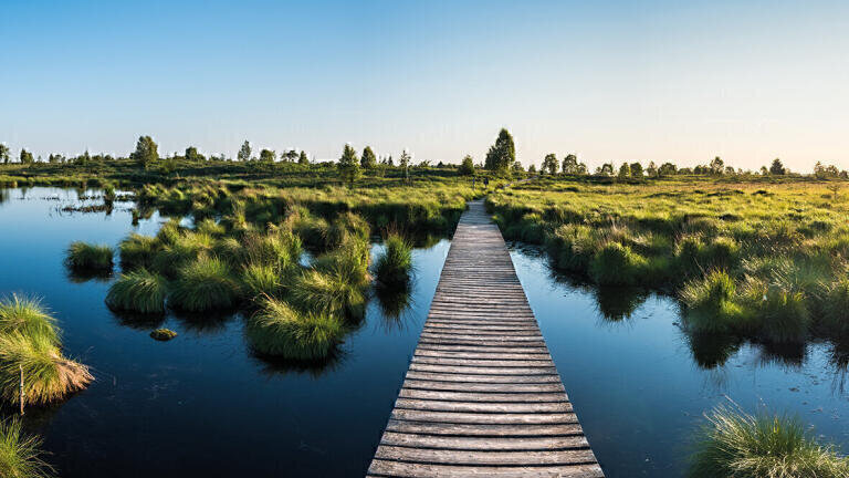
Just such an ecosystem is peatlands, a unique environment that forms on peat, which itself is a type of soil that develops in waterlogged conditions. These conditions mean that dead plants such as moss cannot rot. The live mosses that grow on peatlands act as sponges, absorbing and holding in water and maintaining the wet conditions of the peat.
Peatlands can be found across the world, from arctic latitudes and high altitudes, to beneath the canopies of tropical rainforests and also in arboreal forests. They are important habitats for many species of rare plants, birds and insects and as such play a major role in maintaining biodiversity.
They are also significant carbon stores. Although peatlands cover only around 3% of the world’s land surface, they are estimated to contain around a quarter of the globe’s soil carbon, some 600 gigatonnes, more than in all the world’s forests.
As well as this, they help mitigate flood risks and contribute to the availability of fresh drinking water.
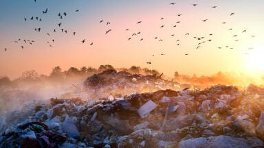
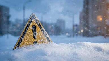
Their importance to the global ecosystem has only been recognized relatively recently and much damage has already been done. Primarily, peatlands are drained for agriculture and forestry and extracted for horticulture and energy. For example, in the UK, at least 80% of peatland habitats have been lost or damaged. As they dry out, peatlands lose their ability to retain carbon dioxide. The CO2 emissions from drained or burned peatlands is estimated to be in the order of two billion tonnes a year.
Although clearly vital to the health of the planet’s ecosystem, peatlands remain little understood, mainly due to the limited research undertaken into their extent, status and how they change.
It is clear that peatlands need to be managed more sustainably if they are to continue to contribute the extensive ecological benefits they can offer. However, to manage them we need to know more about them – how they are developing, what parameters are changing, how quickly, in what areas and over what extent.
Peatlands can be assessed through ground monitoring or via remote sensing methods. Remote sensing encompasses techniques such as LiDAR (Light Detection and Ranging), synthetic aperture radar and high resolution optical imagery obtained from orbiting satellites. The first two methods are often prohibitively expensive and satellite methods also require some time and skill to interpret the imagery.
Satellite monitoring methods also face major challenges. Among these is the fact that peatlands are affected by many complex factors, including the topography of the land, the texture of the peat, local usage patterns and the incidence of fire.
Optical Earth observation of forest peatlands can also be affected by cloud cover and the density of the forest canopy, while radar methods, although they can penetrate cloud cover, suffer from noise caused by surface vegetation.
This means that satellite surveillance must still be backed up by ground observations and field measurements.
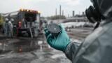
Fortunately, some of the major types of information we need about peatlands can be obtained through relatively inexpensive ground monitoring techniques. Some of the major parameters that tell us about the health of peatlands are the degree of subsidence, the depth of the water table and the amount of greenhouse gas emissions.
Subsidence is typically measured via subsidence poles, which are simply poles made from a durable substance such as PVC. These are inserted into the mineral substrate underlying the peat to maintain stability. A free moving PVC collar is place over the pole, allowing a fixed recording of the height of the peat surface. This collar needs to be heavy enough not to float when flooded but light enough not to sink into the peat itself. Avoiding disturbance of the peat around the pole sites during installation is vital to prevent inaccurate measurements.
The Roundtable on Sustainable Palm Oil (RSPO) has recommended the installation of at least one and preferably two subsidence poles for every 240 hectares of oil palm plantations on peatlands. Poles need to be placed across a range of representative land use types, with a higher density of poles required for peatlands with a variety of peat types, depth and drainage conditions. The RSPO recommends that peat surface elevation be recorded at least every quarter to capture seasonal variations, with measurements conducted over at least three years to provide reliable subsidence data. [1]
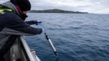
Water table depth is measured via dipwells. These are simply constructed from PVC tubes inserted into the peat to enable the measurement of the water-table depth below the surface. The depth to the water table is monitored by measuring the distance from the water table in the dipwell to the top of the dipwell.
Determining the rate of GHG emissions is achieved using flux towers, which collect data on the exchange of carbon dioxide between the earth and the atmosphere, particularly CO2.
Gaining sufficient data on the subsidence experienced by peatland or on the changes in water level is a challenge, particularly where the peatlands extend over a large area. Peat surfaces can change dramatically, making it advisable to capture data frequently.
However, this is not always possible. Peatlands can be in remote or difficult to access areas, making manual collection of data often unfeasible. With limited human resources, an organization charged with monitoring peat conditions may find it cannot gather enough data at the required frequencies. There is also the issue of manual visits resulting in damage to the peatlands through increased footfall.
These issues can be mitigated by automating the collection of data, allowing more frequent collection and thus improving the quality and utility of the dataset, while avoiding disturbance to the peatland’s delicate ecosystem.
Achieving automated readings is done through the use of sensors that can collect data and send it over the Internet of Things (IoT). Examples include a system developed by the UK’s Centre for Ecology and Hydrology which has developed a time-lapse camera that takes daily observations of peat surface elevation. [1]
The system consists of a time lapse camera mounted on a lightweight platform. The platform ‘floats’ on the peat surface, allowing the camera to take a photograph of a target attached to the subsidence pole and providing a high resolution measurement of the relative displacement between camera and target. Instead of sending the actual photograph, the system uses software to extract the measurement data from the image and sends this instead. Such a system cuts the data to be sent and would allow low bandwidth IoT connectivity methods to be used.
Another example of IoT in peat management is a project conducted at the Raja Musa Forest Reserve (RMFR) in Kuala Selangor, Malaysia. [2]
The project uses sensors for soil temperature and humidity alongside an electronic piezometer used to measure the peat’s water level. A wireless gateway has been set up at a nearby lookout tower to collect all data from the sensor nodes using LoRa® (Long Range) technology.
In Europe, one of the first projects of its kind is using a network of remotely monitored IoT sensors to help monitor the health of peatland in Scotland’s Western Isles. [3] Using these IoT sensors in a remote area has enabled the project to gather real-time live data, vital to monitoring how the water table responds to efforts to restore the peatlands.
Indirectly, peatlands can be protected by ensuring that farmers extract only the water they need for irrigation, avoiding depletion of the fragile water supplies that support peat bogs. This can be done by monitoring soil and leaf humidity using IoT sensors, giving a more accurate picture of the water needs of crops.
The monitoring of peatland conditions involves taking frequent sensor readings over extended periods of time, sending small amounts of data from sensors distributed over a wide area, often in difficult to reach or remote areas.
Accessing this data is therefore a challenge, requiring a connectivity system that is both robust, offers constant access and requires little maintenance or manual visits.
LoRa®, short for Long Range, is ideal to meet these challenges. It takes the form of a low power, terrestrial wireless platform for IoT, based on a series of integrated circuits developed by Semtech.
Transceivers configured with these LoRa devices are embedded into end nodes, or sensor devices, such as a piezometer. These sensors capture data and transmit it to gateways, which in turn send it over the air to the network.
For remote monitoring of peatlands over extended areas, LoRa® compares well with terrestrial connectivity technologies such as 4G and fibre. LoRa® offers rapid deployment over a wide area, reducing both capital and operational costs. It offers advantages over cellular technologies such as Narrowband IoT (NB-IoT), whose devices consume a lot of power, and which therefore need frequent battery replacement.
LoRaWAN® (Long Range Wide Area Network) is the open-source network architecture standardized for LoRa devices and developed by the LoRa Alliance. It becomes even more useful when combined with satellite access.
Less than 20% of the Earth’s surface has terrestrial connectivity. Due to the significantly lower density of users in remote areas, it’s unlikely that terrestrial services will ever see major expansion beyond their current deployment. In particular, serving the often remote wilderness areas where many peatlands are located is beyond the economic viability of terrestrial networks. This leaves a requirement for connectivity that is best served by satellite.
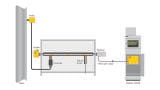
An example offering is a solution offers LoRa coverage across Europe via a large, high capacity satellite. IoT sensors sited at peat bogs measuring water levels, subsidence, temperature and GHG densities, would send data to a LoRa module. The module then uses licensed S-band frequencies to send the data to the satellite, where it is sent to the Internet via a satellite gateway Earth station and a LoRaWAN® compatible network infrastructure.
For environmental monitoring, S-band offers great advantages over other bands, in particular its significant resistance to signal fading caused by rain, snow and ice. This means it can continue to provide access to data from peat monitoring sensors during changing atmospheric conditions, such as the inclement weather often experienced in Europe.
One of the major attractions for researchers investigating the changes happening to peatlands is that, while terrestrial connections can cover short to medium distances, satellites can cover a whole continent. This offers the opportunity of continent wide research programmes that can take account of changing climate conditions and weather patterns, correlating these with changes to the peatlands over a very wide area. A real time view of a whole continent’s peatlands could offer new opportunities for novel insights about peatland degradation that could not be gleaned from a more partial view of isolated areas.
This continent wide access to data is best achieved using satellites in a Geostationary Earth Orbit (GEO). GEO satellites travel at the same angular velocity as the Earth and therefore they appear to remain fixed above the same point. This means that satellite antennas on the ground do not have to track the satellite and can remain pointed at a fixed place in the sky, simplifying the design of ground equipment.
Further benefits are gained from the use of LoRa® Frequency Hopping Spread Spectrum [LR-FHSS] in licensed S-Band. Developed by Semtech, LR-FHSS allows direct to satellite data links from IoT devices with greater reliability, higher performance, lower power consumption and additional robustness to interference.
It’s clear that satellite enabled IoT offers great advantages in the struggle to understand and protect peatlands. With anytime, anywhere access to current field data, researchers have a powerful tool with which to protect these vital natural resources.
[1] Peatland mapping and monitoring – Recommendations and technical overview – Food and Agriculture Organization of the United Nations https://www.fao.org/3/ca8200en/ca8200en.pdf
[2] https://www.mimos.my/wp-content/uploads/2020/11/Preventing-Forest-fire_latest27Oct.pdf
[3] https://www.farrpoint.com/news/Scottish-IoT-project
IET 36.3 May


.jpg)