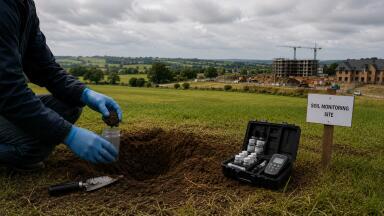
Soil testing
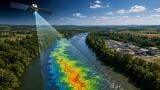
A new drone-based sensing system developed by researchers at the University of Malaga could open up a faster way to screen contaminated soils and disturbed land, particularly at sites that are difficult, unstable, or hazardous to access on foot.
The prototype, known as REMINLASER, has been designed to carry out high-resolution geochemical mapping from the air. Although the University of Malaga is presenting it primarily as a tool for identifying critical raw materials in mining waste, the technology also has a clear environmental monitoring angle. For soil professionals, its significance lies in the possibility of rapidly mapping the surface chemistry of large areas and identifying potential contamination hotspots before more detailed ground investigation begins.
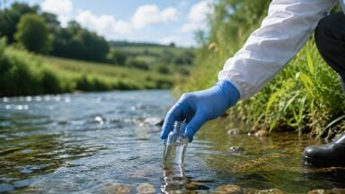
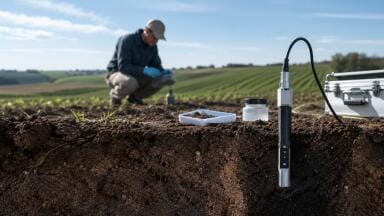
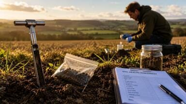
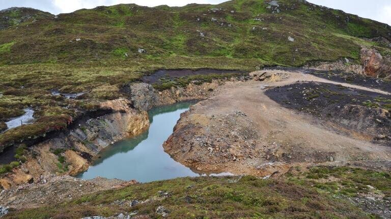
Contaminated land is rarely uniform. Former industrial sites, mine waste heaps, tailings, landfill margins, and other disturbed landscapes often contain highly variable concentrations of metals and other substances, spread unevenly across the surface. That makes early-stage site characterisation difficult. Traditional soil investigations remain essential, but they can be time-consuming and expensive, especially where large areas need to be covered or access is physically challenging.
REMINLASER points to a different kind of front-end workflow. Instead of relying solely on manual sampling to establish the first picture of a site, practitioners could potentially use an airborne system to scan wide areas remotely, identify anomalies, and then target field teams and laboratory analysis more precisely.
That does not remove the need for confirmatory sampling, but it could make site assessment more efficient and more spatially informed.
The new platform has been developed by the University of Malaga’s Instrumentation for Extreme Environments team, working with the Mining Waste and Environmental Geochemistry Research Group at the Geological and Mining Institute of Spain (IGME-CSIC). It builds on an earlier drone-based platform called Chemocopter, but the researchers say REMINLASER takes that earlier concept further by turning it into a more operational airborne instrument for real-time in-flight geochemical screening.
At the centre of the system is Laser-Induced Breakdown Spectroscopy, or LIBS, a technique that uses a laser pulse to interact with a material and generate a spectral signature linked to its elemental composition. According to the university, REMINLASER is the first airborne LIBS system capable of acquiring and transmitting geolocated spectra in real time from an unmanned platform, enabling remote chemical analysis over large surface areas.
The team says the system has been reduced sufficiently in size and weight to be mounted on a drone and has now been validated under realistic operating conditions. Alongside the hardware development, the researchers also developed a dedicated analytical method to support the airborne measurements.
The strongest monitoring relevance of this story lies in surface screening.
Where soils are contaminated by mining, metallurgical activity, industrial waste, or legacy pollution, practitioners often need a quick way to identify areas of concern across a site before deciding where to concentrate more detailed investigation. A drone-mounted LIBS platform could help fill that role. By detecting geochemical variation across the surface, it may allow investigators to distinguish cleaner ground from anomalous areas and to build a more detailed spatial picture of contamination distribution.
That could be especially useful at sites where conventional field access is difficult. Spoil heaps, tailings deposits, eroded mine waste, unstable ground, and operationally risky zones are all environments where a remotely operated platform offers obvious advantages. Reducing the need for personnel to enter hazardous areas while still generating actionable data would be a meaningful step forward for some forms of contaminated land work.
The system may also prove useful in large-area screening, where traditional grid-based sampling would be slow or prohibitively expensive as an initial assessment tool.
It is important, however, not to overstate what a system like this can do. Environmental soil assessment depends on more than surface chemistry alone. Practitioners still need direct samples, laboratory analysis, validated methods, and often additional information on contaminant mobility, depth distribution, exposure pathways, and regulatory thresholds.
An airborne LIBS platform is therefore better understood as a screening and targeting tool than as a replacement for standard contaminated land investigation. Its real value would lie in helping teams prioritise fieldwork, identify hotspots earlier, and improve the efficiency of sampling campaigns.
That in itself would be valuable. On many contaminated sites, one of the biggest practical problems is not the lack of analytical tools, but the difficulty of knowing where to focus them first.
The University of Malaga places REMINLASER in the context of Europe’s growing interest in critical raw materials. The system is being promoted as a way to identify and evaluate valuable elements in mining waste, supporting more secure and sustainable resource supply chains for sectors such as batteries, renewables, electronics, and aerospace.
But that same capability has a second life in environmental monitoring. Technologies developed for resource recovery and mining intelligence often have wider applications in environmental assessment, particularly where they can characterise waste materials, disturbed surfaces, or legacy industrial land.
That crossover is what makes this story relevant to soil monitoring readers. Even if the first market is mining and raw materials, the environmental use case is clear: faster geochemical reconnaissance, safer access to difficult terrain, and better-informed site investigation.
REMINLASER also reflects a broader direction of travel in environmental monitoring. Soil investigation is becoming more layered, combining drones, remote sensing, geospatial data, field instruments, and laboratory workflows rather than relying on one method alone. The aim is not to replace established techniques, but to generate better site intelligence earlier in the process.
If airborne LIBS systems can be made robust enough for routine use, they could become part of that layered toolkit. For contaminated land professionals, the attraction is straightforward: more coverage, faster screening, and better targeting of limited field resources.
IET 36.3 May


.jpg)