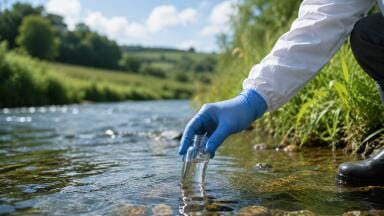
Soil testing
But they could help farmers, advisers and environmental managers decide where to measure, what to compare, and how to interpret soil data more effectively.
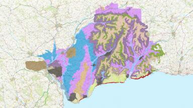
A new set of high-resolution soil and landscape maps for Great Britain could become an important piece of decision-support infrastructure for people already involved in soil monitoring.
Developed through the AgZero+ programme, the maps are designed to provide a more detailed, harmonised and updateable picture of the soils underpinning UK food production and ecosystems.
The most interesting aspect of this story is that these maps could help users monitor more intelligently.
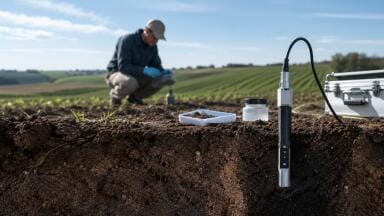
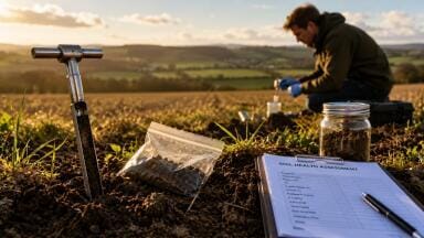
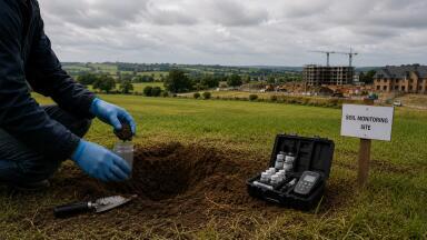
The monitoring itself will still be done by the usual mix of actors: farmers, agronomists, land agents, contract sampling firms, laboratories, researchers, environmental consultants and public bodies.
They are the ones collecting samples, measuring pH, nutrients, organic matter, compaction and moisture, and trying to link those readings to productivity, resilience and environmental performance.
What the new maps offer is a stronger spatial framework around that work.
In practice, that could improve one of the most basic but important parts of soil monitoring: deciding where to measure.
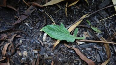
Fields and landscapes are often managed as though they are relatively uniform, even when underlying soils, terrain and hydrology vary significantly over short distances.
If the new maps help users identify those differences more clearly, they could support more targeted sampling strategies and reduce the risk of drawing conclusions from poorly placed measurements.
A compaction result, an organic matter level or a moisture trend means something different in one soil class than it does in another.
The AgZero+ release notes that the maps could help farmers compare soil health against nationally representative benchmarks.
That is a strong signal for anyone involved in soil analysis, advisory services or digital agronomy: the value of a measurement increasingly depends not just on the number itself, but on whether it is being interpreted against the right baseline.
The same logic applies to software and digital tools. One of the stated uses of the new dataset is to support the e-Planner tool, helping land users identify areas that could be managed differently to create environmental gains such as pollinator habitats or reduced flood risk.
That makes this more than a static mapping exercise. It suggests a future in which soil data is more tightly integrated into decision-support platforms that combine maps, models and field measurements.
For suppliers of geospatial services, farm software and environmental data platforms, that is where the commercial relevance may lie. Better baseline soil maps can make digital tools more useful, but they can also raise expectations around data integration, benchmarking and update frequency.
If land managers start relying more heavily on mapped soil context to guide measurement and management, platform developers and service providers may face greater pressure to show that their tools can work with richer spatial datasets.
The release says the maps could support research into soil health risks, improve habitat mapping and help people understand how soils are formed across the landscape.
In other words, they are part of a broader move towards treating soils as a foundational layer in environmental intelligence not just an agricultural input. That has implications for flood modelling, habitat restoration, erosion risk assessment and land-use planning, all of which depend on better baseline information.
The important caveat is that this is not a stand-alone instrumentation story. The maps will not monitor soils by themselves. Their value lies in shaping how existing monitoring is designed and interpreted.
For instrumentation users, the practical question is not whether a new sensor is involved, but whether better maps can help ensure that sensors, samples and surveys are deployed in the right places and read against the right context.
That is what makes the story relevant. High-resolution soil mapping may sit quietly in the background, but it could improve the quality of on-farm and landscape-scale decision-making by helping people target their monitoring more precisely and make better use of the data they already collect.
IET 36.3 May

.jpg)


.jpg)