Portable & field testing
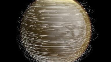
The European Space Agency’s Digital Twin Earth (DTE) programme is at the centre of this change.
The Agency are building dynamic digital twins of key Earth systems that ingest satellite data in near real time, use artificial intelligence (AI) to detect patterns, and run advanced models to simulate future conditions.
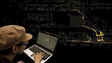
For environmental professionals, DTE is designed not just as a scientific experiment, but as a practical decision-support layer for day-to-day monitoring.
Digital Twin Earth is ESA’s effort to create high-fidelity, continuously updated virtual replicas of Earth’s major systems by combining satellite Earth observation, AI and physics-based modelling.
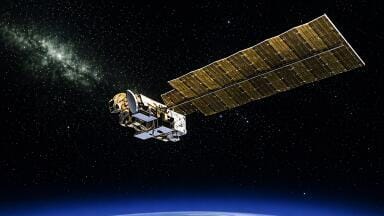
Data from missions such as the Copernicus Sentinels and ESA’s Earth Explorers feed directly into models of the atmosphere, hydrology, ecosystems, ice, coasts and human activity.
Unlike traditional models that run periodically and produce static outputs, DTE aims for live, interactive environments.
Users can visualise current conditions and run scenarios – for example, testing how a drought might evolve across a river basin, or how different mitigation policies could affect emissions, flood risk or land use over coming decades.
The programme is currently pre-operational: ESA is funding and coordinating prototype twins to prove their value and reliability, with the intent that successful components migrate into operational services.
DTE also acts as an innovation engine for the EU’s Destination Earth (DestinE) initiative, which is building an operational digital twin of the entire planet.
DTE sits at the convergence of three elements: satellite measurement, AI and numerical modelling.
Continuous satellite measurements provide the core evidence base: atmospheric composition, land cover, vegetation indices, soil moisture, surface temperature, ice elevation, sea level, ocean colour and more.
This ensures each twin is tightly anchored to observed reality rather than running “free” simulations.
AI and machine learning process the large data flows, detecting anomalies, learning patterns and filling spatial or temporal gaps.
They can emulate computationally expensive processes to accelerate forecast cycles, and generate predictions such as emerging pollution plumes, crop stress or shifting fire risk based on historical and real-time data.
Underneath each twin is a coupled set of numerical models: climate, hydrology, ocean circulation, crop growth, ice dynamics, coastal processes and ecosystem models.
These are continuously updated with observations and linked together so that, for example, a change in land cover alters regional climate and hydrology in the simulation.
Users can modify parameters or inject hypothetical events and see how system responses propagate through the model chain.
All three elements are integrated in a way that supports continuous updating and user-driven exploration.
For monitoring professionals, the crucial shift is from one-off model runs to persistent, interrogable environments that reflect both current conditions and plausible futures.
To support this, ESA has developed the Digital Twin Earth Framework: a technical backbone that standardises how twins are built, run and connected.
It provides common data pipelines, model interfaces and computing resources, and is designed to plug directly into the wider DestinE platform.
Two enabling services are particularly relevant to end users.
DestinE-style streaming of data, inspired by consumer video platforms, allows users to interactively stream only the slices of high-resolution model output or satellite time-series they need, instead of downloading entire datasets.
This lowers storage requirements and speeds up analysis.
Synthetic scene generation creates realistic simulated satellite data for hypothetical scenarios or future sensors.
These synthetic scenes can be used to train AI algorithms, test new mission concepts and fill observational gaps, which is directly useful for instrument developers and algorithm teams in the monitoring sector.
At the core of DTE are Earth Observation Digital Twin Components (EO DTCs) – individual, domain-specific twins that act as building blocks of a broader digital Earth. Each DTC is a focused project aimed at a particular environmental challenge.
A forest twin monitors forest condition and carbon stocks, initially focused on Europe.
It integrates satellite imagery, forest inventories and climate data to track growth, disturbance, pests and fire risk, and to assess how alternative management strategies affect carbon sequestration and resilience.
A hydrology twin models the water cycle from precipitation to river discharge, groundwater and hydro-hazards.
It fuses weather data, in situ observations and satellite products (e.g. soil moisture, snow cover) to forecast floods and droughts and explore water management options under changing climate conditions.
An agricultural twin combines high-resolution imagery, crop models and machine learning to deliver in-season crop monitoring, yield forecasting and scenario analysis.
It can, for example, predict the effects of heatwaves, droughts or altered irrigation regimes on specific crops, supporting both farm-level decisions and food security planning.
A cryosphere twin focuses on Greenland, Antarctica and other ice masses, integrating altimetry, temperature data and ice flow models to project contributions to sea-level rise under various warming pathways, providing critical input for coastal risk assessments.
A coastal twin models the dynamic land–sea interface, taking into account storms, sea-level rise, river flows, erosion and water quality.
It produces advanced flood and erosion risk maps and can simulate combined hazards, such as storm surges coinciding with river floods, to support coastal planning and defence design.
In total, ESA is supporting 13 DTCs across themes including terrestrial biosphere and carbon cycle, ocean dynamics and ecosystems, biodiversity, air quality and health, urban resilience, wildfire risk and Arctic change. Each is co-designed with domain experts and end users to ensure practical relevance.
For environmental monitoring professionals, DTE’s value lies in the way it combines observation, modelling and scenario analysis into one environment.
Climate-focused twins allow agencies to track indicators such as temperature anomalies, carbon fluxes and ice mass loss in near real time, while also testing mitigation and adaptation scenarios.
This helps translate climate science into quantitative, policy-ready evidence for emission targets, adaptation strategies and progress tracking.
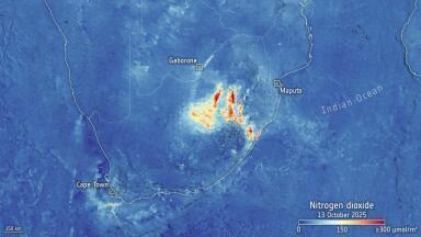
Air quality twins assimilate satellite and ground-based composition measurements into high-resolution atmospheric models to forecast episodes and evaluate interventions.
City authorities, regulators and health agencies can assess the impacts of changes to traffic, industrial emissions or urban design on pollutants such as NO₂ and PM.
Hydrology and coastal twins can be configured to include water quality parameters, aiding the management of algal blooms, thermal pollution and nutrient loading.
Users can test, for instance, how upgrading wastewater treatment or altering abstraction regimes would influence downstream ecosystems and compliance with water directives.
Agricultural twins support precision agriculture and strategic planning by providing early-warning signals for crop stress, optimised irrigation schedules and long-range impacts of climate scenarios on regional production.
This is useful for environmental services, insurers and food security agencies.
Forest and terrestrial biosphere twins enable continuous monitoring of forest health, illegal deforestation and ecosystem change, as well as scenario testing for different management or restoration strategies.
Biodiversity-oriented twins can explore species distribution shifts and habitat connectivity under different land-use or climate futures.
Coastal, hydro-hazard, wildfire and urban resilience twins allow authorities to rehearse disaster scenarios virtually, test protective measures and refine early warning systems.
By modelling hazard cascades and interactions, they provide a more realistic basis for risk assessments, contingency planning and infrastructure investment.
DTE’s impact is multiplied by its integration with the EU’s Destination Earth initiative.
DestinE is building the operational, pan-European platform, including a shared data lake, a digital twin engine running on high-performance computing and user-facing access services.
In practice, this means DTE prototypes can be scaled up to continental or global domains, run at higher resolution on exascale systems and exposed through standard interfaces to a broad user base of public authorities, researchers and private providers.
Common standards promote interoperability between different twins and with national or local modelling efforts, supporting federated digital twin ecosystems across Europe.
For monitoring professionals, the benefit is straightforward: instead of dealing with fragmented datasets and isolated models, they gain access to a coherent environment where climate, hydrology, ecosystems, coasts and human systems are simulated together, backed by shared infrastructure and maintained by leading European institutions.
ESA’s Digital Twin Earth programme marks a significant shift in environmental monitoring, from periodic observation to continuous, interactive simulation.
By fusing satellite data, AI and advanced models into dynamic digital twins, it offers monitoring professionals a way to interrogate both present conditions and plausible futures, and to test interventions virtually before acting in the real world.
Through its tight coupling with Destination Earth, DTE is moving beyond research pilots towards operational services that can be embedded in everyday workflows – from water management and air quality control to coastal defence, forestry and climate policy.
For environmental professionals, engaging with these tools early will be key to exploiting their full potential as they mature into central components of Europe’s environmental information infrastructure.
IET 36.5 Sept/Oct 2026


 Product directory







.jpg)

.jpg)