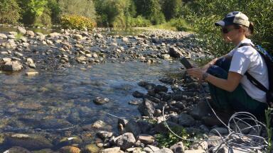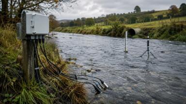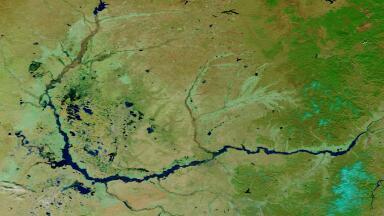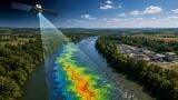
Water monitoring
It shapes flood preparedness, reservoir operations, irrigation planning, and the protection of freshwater ecosystems.
But in many river basins, forecasting remains constrained by the same old problem: too few long-term records from too many unevenly monitored stations.
Researchers at Jeonbuk National University in South Korea say they may have found a practical way around that.
In a new study published in Environmental Modelling & Software, the team presents a clustering-based machine learning framework designed to forecast water levels across whole river networks without requiring a separate AI model for every monitoring station. For water monitoring professionals, the attraction is clear: wider forecasting coverage, lower computational burden, and usable predictions even where historical datasets are patchy.
Hydrological forecasting has become more important as climate change, urbanisation, land-use change, and rising demand place greater pressure on rivers and reservoirs. Water managers need better short-term visibility of changing levels, not only for flood warning but also for irrigation scheduling, infrastructure management, and ecological protection.
Traditional hydrodynamic river models can do this, but they are data-intensive and often difficult to deploy at scale, especially in data-scarce regions. Machine learning has emerged as an alternative, but it comes with its own practical constraint: many monitoring stations simply do not have long enough records to train reliable station-specific models.
That creates a familiar problem for monitoring networks. A watershed may contain many stations, but only a small number have sufficiently long, consistent time series to support robust forecasting.
The Jeonbuk team’s answer is to stop treating every station as a standalone forecasting problem.
Rather than training separate AI models for each monitoring point, the researchers grouped stations according to similar hydrological behaviour. Within each cluster, they selected the station with the longest historical record, trained a model on that representative site, and then applied the trained model to the other stations in the group.
That may sound like a modest conceptual change, but its practical implications are significant. It reduces the number of models that need to be developed and maintained, cuts computational cost, and extends forecasting capability to stations that would otherwise be excluded because their records are too short.
In other words, the framework is designed to make incomplete monitoring networks more useful.
For readers in water monitoring, the most interesting aspect of this work is not just the machine learning itself, but the operational logic behind it.
Many real-world monitoring networks are uneven. Some stations have long, high-quality records. Others have gaps, inconsistent maintenance histories, or relatively recent installation dates. Yet water managers still need watershed-scale situational awareness, particularly during high-flow events or periods of water stress.
A framework that can use a few representative long-record stations to support forecasting across a much broader network could make monitoring systems more scalable and more decision-ready. That matters for agencies trying to build early warning systems without waiting decades for every station to accumulate a long archive.
It could also be useful in agricultural catchments, where water level dynamics affect irrigation decisions, drainage management, nonpoint source pollution control, and ecosystem health.
The researchers argue that the approach has immediate practical value for water resource managers, emergency planners, and agricultural users. Accurate short-term forecasts can support flood warning systems, improve reservoir and irrigation management, and strengthen decision-making during extreme weather events.
The stronger claim, though, is about coverage. Because the system reduces computational demands and does not require long-term records at every point in the network, it may help agencies expand forecasting to stations that would otherwise remain outside the modelled system.
That is particularly relevant in regions where hydrological data remain sparse. If the method performs well beyond the study setting, it could offer a route to more accessible forecasting in basins where conventional models are too data-hungry and fully bespoke AI models are impractical.
As with many AI-led forecasting studies, the promise lies in operational scalability rather than theoretical novelty alone. Water managers are not short of models in the abstract; they are short of models that can work across imperfect networks under real institutional constraints.
That said, the key question for practitioners will be how transferable the clustering approach proves to be across different river systems, climate regimes, monitoring designs, and hydrological extremes. Stations may behave similarly under normal conditions but diverge sharply during rare events, infrastructure interventions, or changing land-use pressures. The quality of the clustering step will therefore be crucial.
There is also a broader monitoring question here. Frameworks like this depend not only on clever modelling choices, but on the continued availability of reliable monitoring data from the representative stations that anchor each cluster. If those key stations fail, drift, or suffer long outages, the wider forecasting system could become more fragile than it first appears.
Even with those caveats, this is the kind of work that monitoring professionals should watch. It reflects a broader shift in hydrology toward data-efficient forecasting systems that are designed to work with the monitoring networks agencies actually have, rather than the ideal ones they wish they had.
Over the next decade, approaches like this could become increasingly important as water systems face more volatile floods, droughts, and seasonal uncertainty. A forecasting framework that can operate across incomplete networks, with manageable computational demands, fits well with the wider move toward real-time water management, automated infrastructure response, and climate adaptation planning.
For the monitoring sector, the takeaway is straightforward: the value of a network may increasingly depend not just on how many stations it contains, but on how intelligently their data can be combined. This study offers one possible model for doing that.
IET 36.3 May


.jpg)

-(1).jpg)