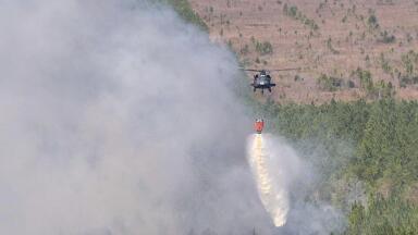
Industrial emissions
Under the new framework, Member States must integrate remote sensing and geospatial data into their monitoring, reporting and verification (MRV) systems for carbon fluxes from land and forest.
That change comes into full focus this October, when experts from across Europe convene to discuss EO-based support for improved MRV under the revised Regulation.
Behind the acronyms and policy language is a deeper question: what does scientifically defensible land carbon monitoring actually look like in the satellite era and who gets to decide?
For years, the EU encouraged Member States to use EO data in their national greenhouse gas inventories. Now, it’s no longer a suggestion.
The revised Regulation requires that land-use emissions and removals be tracked using advanced monitoring technologies such as remote sensing.
This marks a cultural shift as much as a technical one.
National inventory systems, long reliant on periodic forest surveys and statistical upscaling, must now align with continuously refreshed satellite-based data.
The ambition is consistency and transparency across the bloc but achieving that will mean tackling big differences in capacity between Member States.
Some, like Finland or Austria, already operate mature, high-resolution forest-monitoring systems.
Others face steep costs, limited technical capacity and uneven access to validated datasets.
In practice, Europe is still building the institutional scaffolding for a shared, satellite-informed land carbon system.
At the core of the debate is how to turn EO data into reliable, policy-usable carbon numbers.
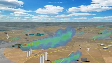
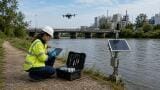
The current generation of sensors - radar, LiDAR, and optical instruments from the Copernicus Sentinel fleet and commercial satellites - can track canopy structure, biomass change, soil moisture and land cover transitions at unprecedented scale.
Combined with in situ field plots and soil cores, these data feed hybrid models that estimate both carbon stocks and fluxes.
But every step introduces uncertainty: cloud cover, sensor bias, sub-pixel heterogeneity, or soil carbon depth assumptions can all distort the signal.
A major theme at the conference will be how to quantify, propagate and communicate these uncertainties.
The outcome could shape how Brussels audits national inventories and how credible land carbon data are considered in future climate policy.
The methodological question is no longer whether satellites can see the change, but whether they can measure it precisely enough to influence compliance and finance.
LULUCF accounting doesn’t exist in isolation. It intersects with national emission inventories, biodiversity monitoring, agricultural policy, and now, increasingly, voluntary carbon markets.
That means harmonising multiple frameworks: the IPCC’s Good Practice Guidance, the EU’s greenhouse gas inventory system, and the data standards emerging under the new Carbon Removals Certification Framework (CRCF).
Agencies must align definitions of land use, land cover, and management so that datasets can talk to each other.
The more ambitious the EO approach, the more coordination it demands.
If Member States each develop bespoke methods, comparability suffers; if the EU imposes a single standard, flexibility vanishes.
This tension between harmonisation and autonomy will dominate LULUCF MRV over the next decade.
Another emerging issue is ownership.
Who controls the EO data streams, models and algorithms that underpin MRV? Public missions like Copernicus are open-access, but many Member States will turn to private data providers and analytics firms to meet their reporting obligations.
That creates new dependencies and potential sovereignty concerns.
If MRV systems are effectively outsourced, how can governments ensure transparency and replicability? Can proprietary algorithms underpin public compliance?
For smaller states, the cost of independence may be too high; for larger ones, the challenge will be interoperability.
Across Europe, pilot projects are testing the fusion of satellite data with national inventories.
In several cases, results are promising: real-time deforestation alerts, improved estimates of forest degradation, and finer-scale soil carbon mapping.
But the early evidence also exposes the limits of automation.
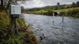
Without robust field networks to calibrate and validate EO data, uncertainty can quietly spiral.
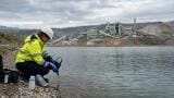
Several national agencies are now revisiting the design of ground truth campaigns, recognising that satellites haven’t replaced fieldwork - in fact, they’ve made it more important.
The conference will likely showcase these mixed results: incremental gains, lingering gaps, and a growing recognition that MRV is not a finished product but an evolving process.
The EU’s goal is clear: by 2030, land use should be a net sink of 310 million tonnes of CO₂ equivalent per year.
But as much as that’s a policy target, it’s also a measurement challenge.
If the data underpinning it remain patchy or inconsistent, the politics of carbon removal could quickly unravel.
Earth observation offers the best hope of building a transparent, verifiable system that can scale.
Yet the danger lies in over-confidence, in treating EO as a panacea rather than a component of a larger, multi-source data ecosystem.
In the end, the credibility of Europe’s land carbon accounting won’t rest on satellite resolution, but on governance: who decides what counts as evidence, how uncertainty is managed, and how transparent those decisions are.
IET 36.2 Mar/Apr 2026


.jpg)