Portable & field testing
In cities like Dhaka, where the haze of construction dust and brick kiln smoke can turn the skyline to sepia by midday, air pollution is a constant feature of daily life.
The World Health Organization routinely ranks Bangladesh among the most polluted countries in terms of annual PM₂.₅ exposure, with levels regularly exceeding global safety thresholds.
This chronic air quality crisis carries deep structural roots: fast urbanisation, an ageing vehicle fleet, unregulated manufacturing clusters, and a historical lack of real-time, spatially distributed environmental data.
Until recently, the country’s monitoring infrastructure was too sparse to capture intra-city variation.
That’s beginning to change.
From government stations and roadside sensors to community-deployed kits and AI-powered models, Bangladesh is rapidly scaling up how it tracks and understands the air its people breathe.
What’s emerging is a decentralised ecosystem of air quality intelligence, one that’s forging a path for developing countries.
The heart of Bangladesh’s official system is the Continuous Air Monitoring Stations (CAMS) network, first launched with World Bank support under the CASE programme.
What started as 11 stations in 8 cities has expanded to 31, with 16 offering continuous, real-time data on key pollutants like PM₂.₅ as well as NOx and SOx.
A real-time Air Quality Index (AQI) portal now broadcasts this data online, and in 2024 the government approved the National Air Quality Management Plan, which outlines a long-term strategy for enforcement and better data transparency.
The Department of Environment is also integrating new roadside monitors – 24 units funded by JICA, including 19 in Dhaka – which aim to detect traffic-related pollution spikes and link those patterns to specific vehicles and driver behaviours.
Beyond the national network, city authorities are deploying their own sensor systems.
In Narayanganj, a major industrial city near Dhaka, a sensor-based Ambient Air Quality Monitoring System (AAQMS) was piloted under ICLEI’s Urban-LEDS II project.
Stationary and portable sensors fed real-time readings to a central dashboard, with LED displays broadcasting AQI scores to the public.
At Dhaka University, a newly established Air Quality Research and Monitoring Center is building local analytical capacity, though public access to the data remains limited.
Meanwhile, researchers are pushing the envelope: a 2024 study used a ring of low-cost PM₂.₅ sensors around Dhaka alongside interpretable machine learning models to distinguish regional haze from local emissions, producing a new layer of diagnostic insight for policymakers.
While reference-grade equipment remains expensive, a wave of community-driven, low-cost sensor networks is gaining traction.
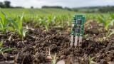
Environmental groups and independent tech enthusiasts have been deploying WiFi and GSM-enabled monitors, such as GAIA’s A12 units, to build grassroots AQ maps in under-monitored neighbourhoods.
Some of these systems run on as little as $200 per unit – a fraction of the cost of government-grade stations – and broadcast real-time AQI readings online.
While power outages and connectivity issues pose challenges, these DIY monitors are beginning to fill in the urban data gaps.
There are even calibration initiatives underway to improve their accuracy using reference data.
What’s emerging is a multiscale, mixed-tech model of air monitoring – one where national networks, municipal pilots, university labs, and citizen science overlap.
The next step? Analytics.
AI models are already helping to predict air quality patterns and optimise sensor placement.
Combined with mobile and roadside sensors, this creates the possibility of hyper-local, time-sensitive interventions: clean air zones and smart traffic rerouting.
As Bangladesh’s air crisis deepens, the infrastructure to measure and manage it is finally catching up.
What was once a void – absent data, absent awareness – is becoming a dynamic, public network.
IET 36.5 Sept/Oct 2026


 Product directory



.jpg)













.jpg)