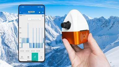
Weather monitoring
That is precisely why it matters.
The satellite is intended to keep one of Copernicus’ most important operational data streams alive: wide-swath, medium-resolution measurements of ocean colour, surface temperature and surface topography, delivered at the cadence needed for forecasting, climate services and large-area environmental monitoring.
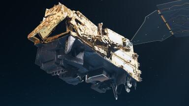
ESA lists Sentinel-3C for launch in 2026 from Europe’s Spaceport in French Guiana on Vega-C, while a March 2026 ESA update said the spacecraft was in environmental testing and had recently completed solar-array deployment tests after acoustic testing.
For readers in environmental monitoring, the key point is continuity. Sentinel-3A launched in February 2016 and Sentinel-3B in April 2018. Sentinel-3C is being brought in to sustain the two-satellite operating concept and eventually replace Sentinel-3A, preserving the regular coverage and timeliness that make Sentinel-3 useful in operational settings rather than just research campaigns.
ESA says the mission is designed to provide essential information in near real time for ocean and weather forecasting, while EUMETSAT frames the extra satellites as guaranteeing continuity into the 2030s.
That continuity rests on a payload that is already well understood by users. Sentinel-3 carries four main instruments. The Ocean and Land Colour Instrument, or OLCI, measures reflected sunlight in 21 spectral bands at 300 m resolution. The Sea and Land Surface Temperature Radiometer, or SLSTR, measures sea and land surface temperatures in nine spectral bands, with 500 m sampling in the visible and near-infrared channels and 1 km in the thermal infrared.
The Synthetic Aperture Radar Altimeter, or SRAL, measures sea and inland-water height, wave height and wind speed, while the Microwave Radiometer, or MWR, provides atmospheric water-vapour correction for the altimeter. ESA also notes that the altimetry package delivers around 300 m along-track resolution after SAR processing and provides 100% coverage in SAR mode across Earth’s surfaces.
From a monitoring perspective, the mission sits in a productive middle ground between coarse global systems and finer-resolution mapping satellites. OLCI’s 1270 km swath and SLSTR’s broad dual-view geometry mean Sentinel-3 can revisit large areas quickly; ESA’s mission facts say that, with the two-satellite constellation, revisit is about one day for SLSTR and two days for OLCI over the ocean at the equator.
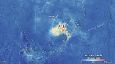
That makes the series especially valuable for phenomena that are spatially extensive and time-sensitive: algal blooms, sediment plumes, marine heat anomalies, wildfire activity, sea-surface temperature shifts, drought stress and cryosphere change.
This is why Sentinel-3C should matter to instrumentation and monitoring professionals even if they never download a raw satellite file. The mission feeds products and services used in ocean forecasting, environmental status assessment, climate reporting and hazard monitoring.
EUMETSAT highlights uses including sea and lake surface topography, sea and land surface temperature, sea-ice and land-ice elevation, ocean and land surface colour, atmospheric composition, clouds, wildfires and gas flares.
In practice, that means Sentinel-3 data often becomes a strategic layer rather than a standalone answer: it helps agencies, utilities, consultants and researchers decide where to sample, where to deploy field instruments, where to intensify inspection and where a ground network may be missing emerging change.
For marine and water professionals, OLCI remains one of the strongest reasons to watch Sentinel-3C closely. Its spectral design supports chlorophyll and other water-quality retrievals across coastal, inland and open-ocean contexts, while the mission’s repeat coverage is well suited to trend monitoring and event detection.
For temperature specialists, SLSTR’s dual-view architecture remains central because it improves atmospheric correction and strengthens sea-surface temperature retrievals, a critical variable for climate surveillance, fisheries, coastal process studies and model assimilation. For altimetry users, SRAL and MWR together sustain an operational stream for sea level, wave state, inland waters and cryosphere applications.
It is also worth being clear about what Sentinel-3C is not. It is not primarily about adding dramatic new measurement types compared with Sentinel-3A and -3B. The value is operational resilience, continuity of calibration and product lineage, and preservation of the two-satellite architecture. For long time series, that stability is often more important than novelty.
Monitoring organisations building dashboards, anomaly services, alerting systems or annual reporting workflows generally benefit more from consistent variables over decades than from frequent sensor discontinuities. ESA’s March 2026 note explicitly frames Sentinel-3C in those terms: ensuring continuity and eventually replacing Sentinel-3A while preserving optimal global coverage and timely data delivery.
There is, however, one major operational change around the mission that users should not ignore: access infrastructure. The old Copernicus Open Access Hub ceased operations at the end of October 2023, and official access is now centred on the Copernicus Data Space Ecosystem.
That matters because many long-running monitoring workflows were built around older download patterns. For Sentinel-3C-era use, data engineering is part of the story: catalogue access, APIs, authentication and cloud-adjacent processing now sit much closer to day-to-day exploitation of Copernicus data.
The broader significance of Sentinel-3C is straightforward. It keeps alive a class of measurements that are extremely hard to replace with ground systems alone: broad-area, repeatable, calibrated observations of water colour, surface temperature and surface topography. For environmental monitoring professionals, that means continuity in some of the background layers increasingly used to interpret field data, target interventions and connect local measurements to regional and global dynamics.
Sentinel-3C is less about a flashy leap than about keeping a mature, heavily used monitoring capability in service at the moment when climate, marine and land surveillance increasingly depend on consistent, decision-ready Earth observation.
IET 36.3 May


.jpg)