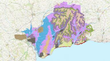
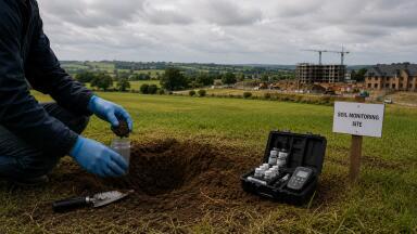
Manually monitoring soil for subtle changes may be a thing of the past in one Canadian region with the introduction of The Eastern Canada Soil & Water Conservation Centre's (ECSWCC) Black Brook Drainage Basin Electronic Atlas.
The Saint-Andre community in New Brunswick will now benefit from the atlas' ability to track aspects such as erosion diagnostics and contour lines for the benefit of soil conservation and planning.
According to the Jean-Louis Daigle, executive director of the ECSWCC, the project is the result of years of work with the ultimate aim of making "planning tools accessible to agricultural advisers and stakeholders in our region".
"They will now have access to an electronic atlas created using the latest breakthroughs in geomatics," the Victoria Star quotes him as adding.
Canada is not the only area which will benefit from the development of such an atlas, as it was reported in January that a digital soil map of 42 African countries is currently being devised by the International Centre for Tropical Agriculture.


.jpg)


2.jpg)