Gas detection
Published over 15 years ago. See the latest and most current information on Gas detection.
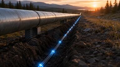
New safety legislation in Europe requires gas distribution companies to monitor their networks on a regular basis (once, twice or three times a year depending on the country). As a result, they are under an increasing obligation to guarantee traceability of their surveys by providing precise location and dating of gas concentrations measured.
Systematic leak detection is therefore part of the overall safety policy of gas distribution companies vis-à-vis the community and their own workforce. Aimed at the early identification of any deterioration of the network, systematic leak detection enables timely remedial action. But network surveys are also part of any maintenance policy, with the dual aim of increased safety and operating efficiency.
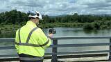
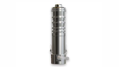
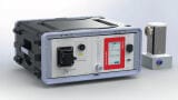
The INSPECTRA® Laser portable detector developed by GAZOMAT™ (France), is used for on-foot inspections. The equipment, which benefits from high performance laser spectroscopy technology, offers below 1 ppm sensitivity as well as total selectivity to methane.
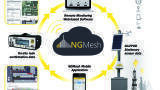
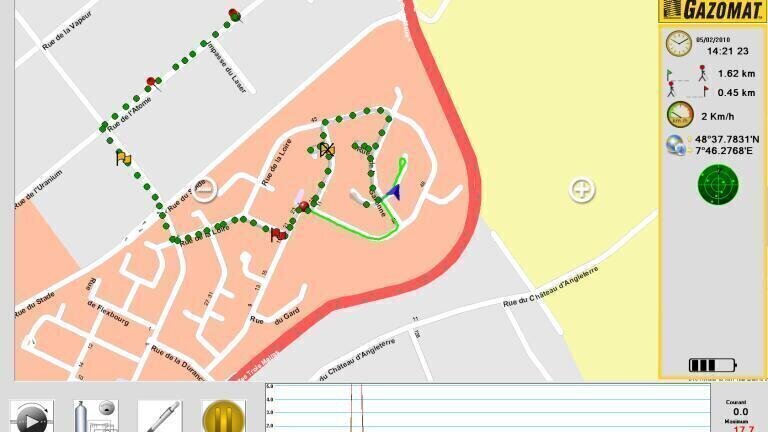
Eager to meet gas companies’ traceability requirements, GAZOMAT™ introduces a new survey software. The NGS software has been designed to ensure total traceability of network monitoring, both from vehicles and on-foot.
In addition, GAZOMAT™ now offers a unique product pack that combines the powerful measurement system of the INSPECTRA® Laser with the capabilities of the NGS software and the convenience of the GPS tablet system.
The GPS tablet displays the map of the survey mission on screen. The NGS software loaded onto the GPS tablet interfaces with and controls the measurement equipment to provide: Real-time visualization on the downloaded road map of the operator’s position and the survey mission’s progress, plus any gas concentration detected; Permanent saving of key survey data, such as concentrations measured, associated GPS coordinates, precise address on the map and operator comments; An interactive and simplified interface with the operator, including pop-up windows and easy-to-understand graphics to guide the operator throughout the mission; A GPS type mapping system – the software integrates a GPS type map, which gas companies can supplement further with building or pipeline network maps in SHAPE format, a standard format used worldwide; and A final survey report in PDF format compiling the information on the survey mission, as well as all events recorded during the mission plus functional tests of the measurement equipment.
The whole set offers gas companies a powerful measurement and positioning tool characterized by its user-friendliness and its traceability.
IET 36.3 May


.jpg)