.jpg)
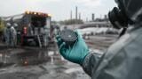
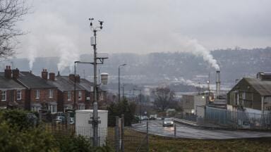
Air quality monitoring
Over the next five years, new satellite missions and model upgrades will vastly improve the spatial, temporal, and compositional detail of particulate pollution data.
For air quality professionals, this means sharper tools for forecasting, compliance, and public health protection.
Two upcoming Copernicus satellite missions, Sentinel-4 and Sentinel-5, are central to the programme’s aerosol ambitions.
Sentinel-4, launching in 2025, will deliver hourly updates on atmospheric composition over Europe from geostationary orbit.
Its continuous scanning will allow real-time detection of pollution events, including aerosol spikes from traffic, wildfires, or Saharan dust.
Meanwhile, Sentinel-5, in polar orbit, will provide daily global coverage with upgraded sensors to detect aerosol optical depth (AOD) and trace gases with enhanced resolution and spectral performance.
Together, these satellites close the gap between snapshot-based observations and the dynamic nature of air pollution.
Also arriving in 2025 is the 3MI (Multi-viewing, Multi-channel, Multi-polarisation Imager), which will deliver high-resolution aerosol type and size data.
This sensor enables discrimination between different kinds of particulates (dust, smoke, sea salt) aiding source attribution and health risk analysis.
The CO2M mission, launching around 2026–27, will also contribute valuable aerosol data.
Though primarily focused on carbon dioxide monitoring, CO2M will feature a Multi-Angle Polarimeter (MAP) capable of detecting aerosol load and properties at 4 km resolution.
This makes it another strong tool for understanding air quality, especially in conjunction with Sentinel and 3MI observations.
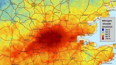
Copernicus is also upgrading its Atmosphere Monitoring Service (CAMS), operated by ECMWF, to provide more accurate near-surface PM2.5 and PM10 forecasts.
The latest modelling cycle includes secondary organic aerosol chemistry and more realistic emission injection heights (e.g., factory stacks), leading to improved surface-level pollution estimates.
Data assimilation is another major upgrade. CAMS will incorporate real-time data from Sentinel-4 and -5 to nudge forecasts closer to observed conditions.
This means better alignment between model predictions and ground-truth air quality station data. For professionals, this adds confidence and utility to regional and urban forecasts.
CAMS already integrates data from hundreds of ground-based sensors across Europe, and this integration is expected to deepen with better modelling and machine learning tools that adjust forecasts using live data.
These assimilation techniques help correct model biases, allowing near-surface particulate estimates to approach the accuracy of direct ground measurements.
Resolution is also improving. Current CAMS global forecasts operate at ~40 km resolution, but this is expected to improve to ~10 km and finer, aligning with regional-scale needs.
For Europe, the CAMS ensemble system already operates at 10 km and is expected to incorporate more localised models to offer better urban-level insights.
Urban air quality is where these advances will shine.
With Sentinel-4’s hourly scans and 3MI’s 4 km resolution, cities will soon receive quasi-continuous pollution updates. Combined with CAMS models, this will enable more precise nowcasting and hotspot detection within metropolitan areas.
Downscaling tools are also evolving. Machine learning approaches are being developed to correct coarse model data using historical station measurements, bringing forecasts closer to street-level conditions.
This opens doors to neighbourhood-specific warnings and highly localised air quality management.
Moreover, these high-frequency satellite observations allow for short-term pollution forecasting that is relevant for real-time decision-making.
For example, identifying the onset of a smoke event, or timing industrial plumes within the day, becomes more feasible when new satellite passes occur hourly rather than daily.
These enhanced datasets will directly feed into public health alert systems, enabling timely warnings for vulnerable groups.
City authorities can act faster on pollution events, while citizens gain clearer, more trusted information.
The EU’s Zero Pollution Action Plan will benefit from better tools to track progress and detect non-compliance.
CAMS and Copernicus data also support wildfire smoke and dust forecasting, solar energy yield prediction, and climate modelling.
The improved understanding of aerosol types and transport pathways means better planning and reduced exposure risks.
Additionally, by merging Sentinel data with CAMS modelling, professionals will be able to estimate aerosol sources and their transport more accurately.
This improves accountability, allowing regulators to trace pollution back to its origin and evaluate policy effectiveness.
Aerosol data also contributes to climate science, particularly in refining Earth system models that account for aerosol-radiation and aerosol-cloud interactions.
These interactions are a major source of uncertainty in climate projections, and higher-resolution, chemically-specific data from satellites like 3MI will help reduce that gap.
All this capability is being backed by improved access through platforms like the Atmosphere Data Store and WEkEO.
Users can expect streamlined tools for exploring high-resolution aerosol maps, APIs for integration, and open-source resources for model downscaling or calibration.
Training and documentation initiatives are also expanding.
As satellite data products become more complex and abundant, Copernicus and ECMWF are investing in resources that help professionals understand how to use the data, from file formats to interpretation and visualisation.
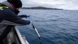
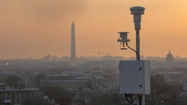
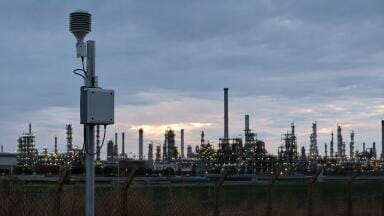
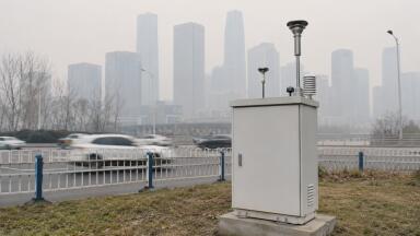
Far from replacing in situ instrumentation, Copernicus upgrades will complement and enhance ground-based networks.
Satellite and model data can help validate sensor networks, fill spatial gaps, and inform siting strategies.
Low-cost sensor networks can even be calibrated against CAMS data for better accuracy.
The synergy between remote sensing and in situ data allows for a more complete understanding of atmospheric conditions.
For example, satellite-derived aerosol optical depth can provide regional context that complements hyperlocal PM2.5 readings, helping to interpret anomalies or unexpected trends.
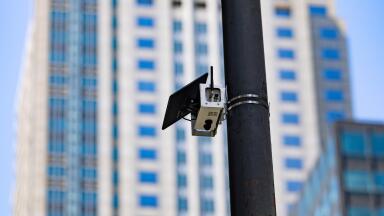
Instrumentation users, from reference-grade analysers to emerging low-cost sensors, will also benefit from more robust data fusion opportunities.
Increasingly, best-practice air quality reporting will rely on blending these data sources for both regulatory and public engagement applications.
The bottom line: professionals will gain a much richer, more timely, and more nuanced view of aerosols.
Whether you’re running regulatory stations, advising policymakers, or developing forecasting systems, Copernicus’ enhanced capabilities will sharpen your assessments, streamline operations, and support smarter decisions.
Clearer skies and clearer data are on the horizon.
IET 36.3 May