Water testing
A new multi-disciplinary review argues that the world’s ditches—those narrow, human-made channels along roads, in fields and forests—are a missing piece of environmental monitoring.
Ditches have powered mills, irrigated crops and drained wetlands for millennia.
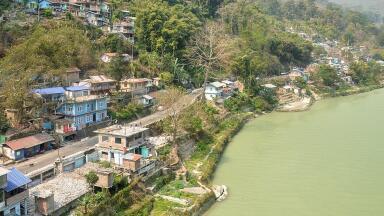
Today they are everywhere—on every continent, even Antarctica—and yet they’re scarcely mapped, barely regulated and routinely dismissed.
That cultural blind spot matters. As co-lead author Chelsea Clifford puts it: “Ditches aren’t actually boring. Try taking a closer look at yours.”
The review, led by a collective of self-described “ditchologists”, reframes ditches as ditchscapes: linear, interlinked socio-ecosystems that store and move water “where humans prefer it to go.”
Their form varies—peatland drains, roadside gullies, farm rhynes, urban conduits—but collectively they shape biogeochemical cycles, biodiversity and human risk at landscape scale.
For monitoring professionals, the proposition is simple: treat ditches as first-mile sensors for everything from nutrient pulses to microplastics, methane hotspots and pathogen transport.
These channels often intersect the very activities that create risk (cropping, forestry, roads, settlements) before contaminants propagate downstream or into aquifers.
Because they’re shallow, accessible and numerous, ditches are high-resolution sampling opportunities.
They can concentrate signals—nitrate surges after fertiliser application, pesticide wash-off, metals from road dust, tyre-derived microplastics—making exceedances more detectable.
That feature isn’t just convenient; it’s predictive.
Clifford again: ditches can be “sentinels of what’s to come” for salinisation and sea-level rise, tipping to marsh or open water before adjacent lands do.
The environmental justice implication is stark. Where mapping and maintenance are neglected, ditches can become hotspots for pollutant loadings and pathogens, often in poorer communities.
The authors warn that this combination of high loads and low governance risks “environmental injustice and exploitation”.
For regulators and utilities, integrating ditch monitoring into complaints triage and equity-centred sampling plans is overdue.
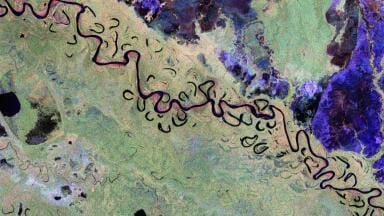
We don’t have good maps. Even recent hydrography updates sometimes erase ditches.
That gap is closing: the team highlights progress from object-based image analysis (2017) to machine learning and AI pipelines (2024) for delineating linear drainage at scale.
Co-author John Connolly notes how modern methods are finally catching the “lines in the landscape”—vital if you’re siting sensors, designing flow paths for isokinetic sampling, or building catchment models that match reality.
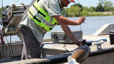
Use UAV photogrammetry or LiDAR to derive ditch networks and longitudinal profiles; push outputs into GIS to plan stations and maintenance access.
Couple low-cost loggers (level, EC, turbidity, ORP) with event-triggered autosamplers at confluences and field outlets.
In urban corridors, add conductivity spikes as a proxy for illicit connections and ammonium for sewage ingress; pair with time-of-travel tracers to locate sources.
For microplastics and tyre wear indicators, integrate inline sieving + μFTIR/Raman workflows at outfalls and roadside drains.
In boreal forests and peatlands, ditch management is now a climate decision. Sweden alone hosts ~1 million km of century-old forestry drains.
The Trollberget Experimental Area (TEA) is testing three pathways at catchment scale: rewetting (ditch blocking), ditch cleaning to lower water tables for timber growth, and benign neglect.
Early findings? Expect site-specific, sometimes counter-intuitive responses across water quantity, quality and greenhouse-gas fluxes.
Rewetting can reduce CO₂ but raise CH₄; cleaning can boost growth (CO₂ uptake) but export sediments and nutrients and stimulate soil C mineralisation.
The message for policy and procurement is clear: instrument first, intervene second.
Deploy eddy-covariance towers, closed-chamber flux systems, dissolved GHG sondes, and continuous turbidity/SSC to establish baselines and capture post-treatment trajectories.
Avoid one-size-fits-all prescriptions.
If ditches are the network you’ve been ignoring, how do you start?
Make them visible. Add a ditch layer to your asset register.
Blend ML-derived vectors, farmer drainage plans, highways data, and community mapping. Treat the layer as dynamic infrastructure, not cartographic noise.
Prioritise nodes, not every metre.
Target junctions, outfalls to natural streams, culvert exits, and segments downstream of high-risk land uses (spray zones, manure storage, depots). Use risk-weighted stratified sampling.
Instrument for pulses. Ditches are flashy. Use stage-activated or rain-indexed autosampling; pair with 5-minute logging on EC/turbidity/temperature and telemetry for alerts.
Where access is limited, consider low-power ultrasonic level sensors and camera-based flow estimation.
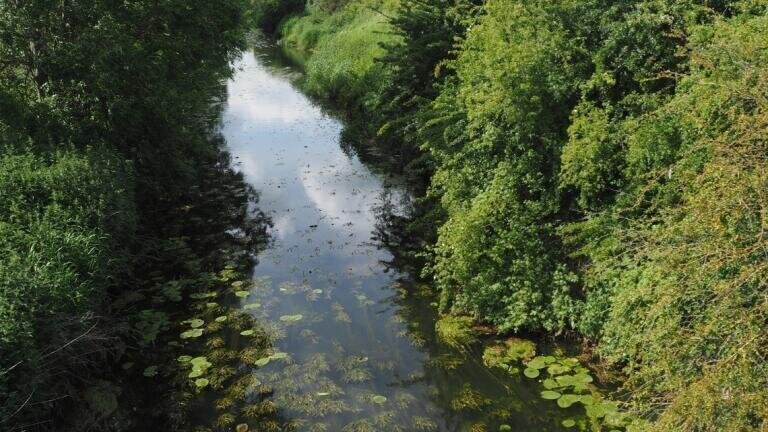
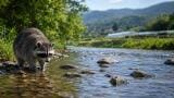
Exploit the corridor. Many ditches are linear conservation assets—habitat for fish, amphibians, waterbirds and rarities like ram’s-horn snails or fen ragwort. Include eDNA sampling to track biodiversity response to management.
Close the loop with maintenance. Monitoring should inform vegetation management, sediment traps, and constructed features (riffles, two-stage benches, denitrifying bioreactors).
Log interventions so water-quality trends can be attributed, not guessed.
Design for justice. Where ditchscapes cut through underserved areas, co-design programmes with residents: co-located sensors, SMS alerting, transparent dashboards, and paid community sampling.
Make ditch data auditable and actionable—link alerts to inspections and enforcement.
Legislation lags reality. In the US, the Clean Water Act does not directly address ditches; in Europe, the Water Framework Directive offers guidance for “artificial and heavily modified waterbodies,” but ditches often fall between categories.
That ambiguity can be liberating—room to innovate—but it also leaves a governance vacuum.
Co-lead author Mike Peacock captures the new mood among specialists: “It became apparent that us ditchologists aren’t perhaps quite as rare as we thought.” The field is ready to move from obscurity to standards.
Envirotech’s readership can accelerate that shift by specifying ditch coverage in monitoring contracts, publishing methods, and pushing for ditch layers in permit conditions and catchment plans.
If your air-water-soil programme doesn’t mention ditches, your network probably isn’t representative.
AI mapping at national scale. Expect ditch layers to join hydrography basemaps, enabling automated siting, travel-time modelling and digital twins that actually match drainage reality.
GHG-aware forestry decisions. TEA-style experiments will shape whether countries fund rewetting, cleaning or abandonment—each with distinct monitoring packages.
Standard methods. From microplastics in roadside drains to eDNA in farm rhynes, look for method harmonisation, QA/QC and inter-comparisons.
Ditch rights and responsibilities. As ditch data expose pollution pathways, liability will follow. Expect more consent conditions and maintenance audits.
Ditches are palimpsests—traces of past land use, naturalised and reworked.
Managed as corridors to the future, they can soak up risk, reveal change early and stitch biodiversity back into working landscapes.
Or, left invisible, they can amplify harm. The choice is empirical, not aesthetic. Instrument them.
As Clifford puts it: “If we’re smart and brave and take initiative about what could be… they could become symbols of hope too.
IET 36.3 May


.jpg)