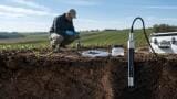
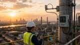
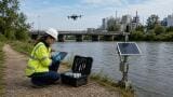
Weather monitoring
As cities across the world continue to expand, and heatwaves become more frequent and severe, urban heat islands (UHIs) are emerging as a critical blind spot in environmental monitoring.
Despite decades of research highlighting their impact, the methods we use to observe and predict urban temperatures often fail to capture the full extent of heat stress in densely populated areas.
Are we adequately monitoring these urban microclimates? There is evidence to suggest that we might not be.
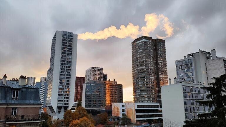
Urban heat islands are localised zones of elevated temperature that occur in built-up areas.
The materials that make up cities – concrete, asphalt, steel – absorb and retain heat far more than natural surfaces.
Combined with reduced vegetation and anthropogenic heat release (from vehicles, air conditioning, and industry), this leads to city centres being several degrees warmer than surrounding rural zones, especially at night.
This heat differential can significantly worsen public health outcomes during heatwaves, strain energy infrastructure, and even affect local weather dynamics.
Yet our monitoring systems still tend to reflect an outdated geographic and technical logic.
One of the core problems lies in where we put our instruments.
Many official weather stations are situated in parks or airports, areas that are cooler, more open and less built-up than urban centres.
In London, for instance, temperature observations from St James’s Park or Heathrow Airport may underrepresent the actual heat burden experienced in dense, heavily paved neighbourhoods like Camden or Elephant and Castle.
These station locations were historically chosen for consistency and data quality, but in the context of urban climate resilience, they now risk masking serious intra-city variations.
Meteorological models are another weak point.
Most national weather models operate on a grid scale of 1–10 km, meaning they average conditions across areas far too large to capture block-by-block variation.
Even when land surface characteristics are included, the urban environment is typically oversimplified, treating the city as one uniform slab rather than a mosaic of heat-trapping and heat-shedding zones.
As a result, public forecasts are generalised, reflecting regional averages that overlook the hottest parts of a city.
This can lead to under-preparedness during extreme heat events, especially in communities that are already vulnerable due to poor housing, lack of green space, or high population density.
The consequences of under-monitoring UHIs aren’t limited to temperature.
A 2025 study from Kyoto University demonstrated that reducing heat emissions from city surfaces can moderate local rainfall.
Researchers simulated a rainstorm over Osaka City, varying the amount of surface heat released in different model runs.
The result: lower sensible heat fluxes led to reduced storm intensity and rainfall volume.
This suggests that urban heat management could influence not just comfort and health, but also storm formation and flood risk.
“We are excited to learn that regulating urban heat release has the potential to help us deal with urban weather-related issues,” said lead researcher Tetsuya Takemi.
To read the full study, click here.
There’s growing recognition of the need for better urban heat monitoring, but are organisations keeping pace with the urgency of the challenge – and which technologies are they exploring to meet it?
Jed Thomas
IET 36.2 Mar/Apr 2026


.jpg)