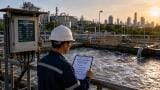
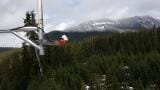
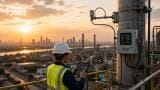
Weather monitoring
As global temperatures rise and cities bear the brunt of intensifying heatwaves, the need for accurate, localised monitoring of urban heat islands (UHIs) has never been greater.
Traditional meteorological infrastructure has long failed to capture the hyper-local nature of urban microclimates, but that’s starting to change.
From high-resolution weather models to satellite data and distributed sensor networks, environmental monitoring is evolving to meet the challenge.
Conventional weather monitoring systems were built for regional consistency, not urban complexity.
Many stations are located in open spaces like airports or parks, which don’t reflect temperatures in densely built-up, poorly ventilated areas.
And while numerical weather models continue to improve, they often operate at grid resolutions of 1–10 km, too coarse to resolve street-level temperature extremes.
This means that vulnerable neighbourhoods may be underrepresented in official forecasts, even though they may face higher health and infrastructure risks during extreme heat events.
The UK Met Office is among the leaders in advancing urban-specific weather forecasting.
Its London Urban Model simulates temperature, wind, and humidity across the city at high resolution using land-use data, building height, and surface material information.
This allows it to represent temperature variability block by block, rather than citywide averages.
These models can integrate local building energy use, traffic emissions, and tree canopy coverage – crucial factors in heat distribution.
Agencies like NASA and ESA are providing increasingly detailed thermal infrared imagery from satellites like Landsat and Sentinel-3.
These images reveal surface temperature patterns across entire metropolitan areas, highlighting heat hotspots such as commercial rooftops, industrial zones, and low-income housing clusters.
This data is being used not just for research, but to inform urban planning, heat mitigation investments, and green infrastructure deployment.
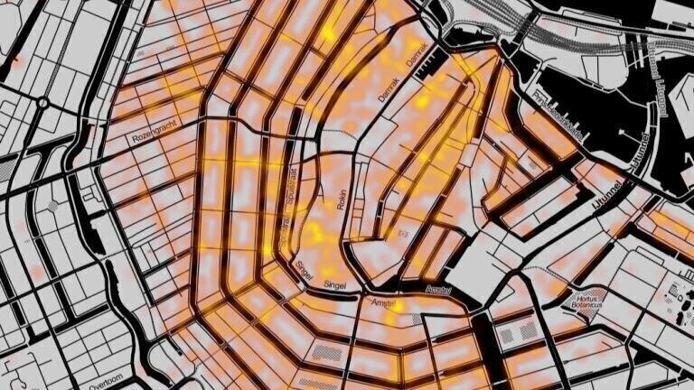
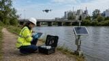
Cities including Los Angeles, Singapore, and Melbourne are deploying dense networks of fixed and mobile sensors to track air temperature, humidity, and radiant heat at the neighbourhood level.
These networks include weather sensors mounted on streetlights or traffic signals, wearable sensors worn by citizen scientists and mobile sensors on delivery vehicles, buses or drones.
The resulting data streams can feed into real-time public dashboards and early warning systems for extreme heat.
Researchers are beginning to use building-scale computational fluid dynamics (CFD) models to understand how heat, air, and moisture flow through individual streets and between buildings. These high-fidelity models simulate urban canyon effects, wind shadows and ventilation corridors.
Coupled with meteorological models, they offer predictive insights into where interventions like shade structures or cool roofs will have the most impact.
Improved monitoring is already guiding policy and practice.
In New York City, hyper-local heat maps informed the rollout of public cooling centres and green infrastructure. In Paris, UHI mapping helped determine the best streets for “urban cooling corridors” lined with shade trees and water features.
Increasingly, cross-sector collaboration is key: urban planners, public health agencies, and emergency responders are beginning to integrate environmental monitoring data into resilience strategies.
For environmental monitoring specialists, the rise of UHI-focused tools opens new opportunities:
Integrate high-resolution urban models into existing monitoring frameworks
Deploy temporary sensors to fill data gaps during heatwaves
Partner with city agencies or universities to share sensor infrastructure
Use remote sensing to evaluate heat mitigation projects over time
Whether through sensor networks or simulation platforms, monitoring professionals play a crucial role in translating raw data into meaningful protection for the people who live and work in cities.
IET 36.2 Mar/Apr 2026


.jpg)


.jpg)