Environmental laboratory
Published over 11 years ago. See the latest and most current information on Environmental laboratory.
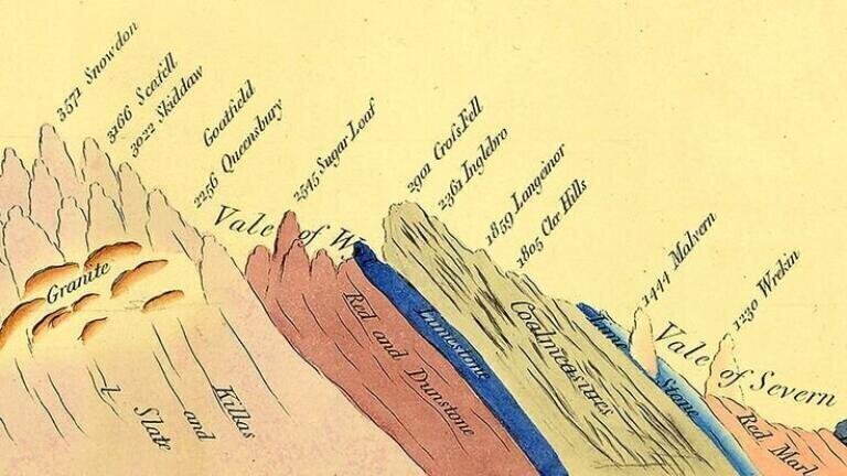
One of the most important maps to world science has been rediscovered, 40 years after it had gone missing. The map, which is an early edition of the first of its kind to be produced anywhere in the world, shows the geology of England, Wales and portions of Scotland.
The map resurfaced in the very archives from which it went missing – The Geological Society. Chairman of the Society’s History of Geology Group, John Henry, explained to the BBC that it had simply been mislaid. “It just wasn’t where people expected it to be. I guess the person who put it away knew where it was, but then they left and that was that – it became lost.”
The map is so important because it was painstakingly created by the man often referred to as the “Father of Geology”, William Smith. Smith spent 15 years collating data for the map, during which time he traversed more than 150,000 miles on foot, horseback and in a carriage. The reason for this was that he had to personally visit each location of geological formation in Britain and document the results.
After being printed from copper plate engravings, the maps were then finished by hand using watercolours, giving them an aesthetically beautiful appearance. An estimated 370 copies of the map were produced in total, and since this one does not bear any serial numbers, we can be certain it was one of the first 50 and more than likely one of the first 10.
Furthermore, because it has been hidden away in its leather case from the harsh glare of light and the damage of inquisitive hands, it is in much better shape than many of its counterparts. All of this combines to make the map a very valuable piece of scientific history – probably as valuable as six figures.
Smith’s time-consuming documentation and hard work was worth it in the end, since by collating the maps, he was able to make a link between the layers of geological rock, the fossils found therein and the passing of time. As such, it is the cornerstone of the way we measure the age of rocks and of fossils to this very day.
While the map is an interesting curio from the early 19th century, it has also enabled some of the most scientific advances of today’s age. The knowledge gained by Smith paved the way for us to understand more about the history of Earth from analysing sedimentary rocks from dry land and from the seabed.
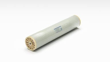
One of the most advanced techniques in doing this is called energy-dispersive X-ray fluorescence (EDPXRF) analysis, which enables us to learn more about our planet. The PDF file On the Trail of the Earth's History with EXPDRF goes into much greater detail about the practice and how it is useful in understanding the place we inhabit.
IET 36.2 Mar/Apr 2026


.jpg)