Water/Wastewater
Scientists 'use satellites to locate water'
Jan 20 2009
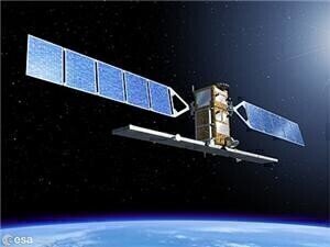
The data is being obtained by the European Space Agency and is assisting in indicating underground water reserves in the drought-stricken Nigerian region of Sahel.
Once located, water sources could be tapped into to provide assistance to farmers' crops and animals, the agency stated.
Water resources scientist currently working on the programme Issifou Alfari stated that the images show where rainfall is most likely to occur and create bodies of water on a seasonal basis.
"We are very happy with the project's scope and outcome, as we believe this source of information will be fundamental for water management activities," he added.
As well as a water map, a soil map of Africa is currently being devised by the International Centre for Tropical Agriculture and will provide a database for farmers and researchers alike, reported the BBC last week.
Digital Edition
IET 34.2 March 2024
April 2024
Gas Detection - Biogas batch fermentation system for laboratory use with automatic gas analysis in real time Water/Wastewater - Upcycling sensors for sustainable nature management - Prist...
View all digital editions
Events
May 03 2024 Seoul, South Korea
May 05 2024 Seville, Spain
May 06 2024 Minneapolis, MN, USA
May 13 2024 Munich, Germany
May 15 2024 Lund, Sweden


