Business news
Published over 3 years ago. See the latest and most current information on Business news.
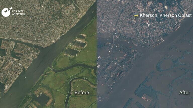
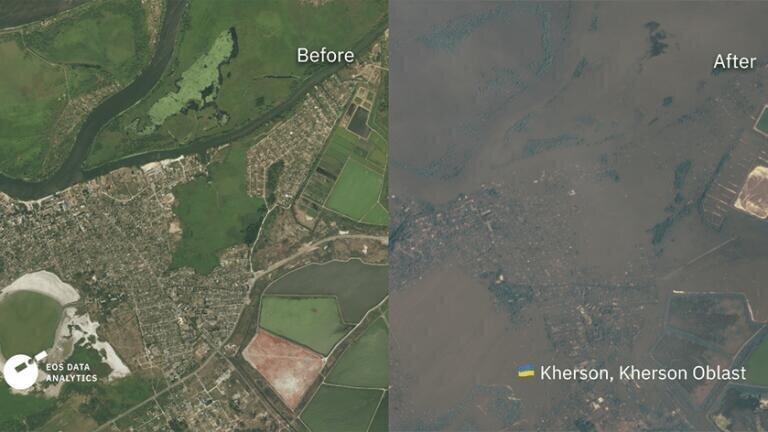
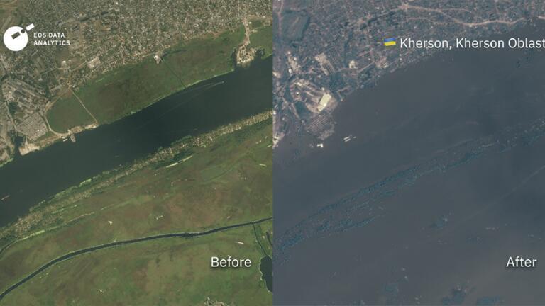
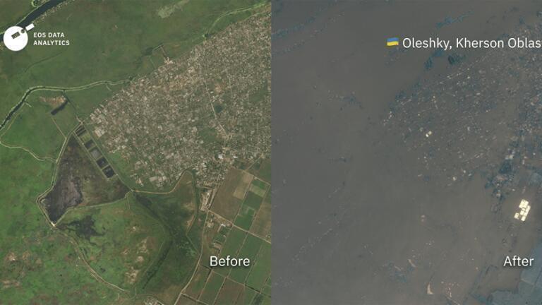
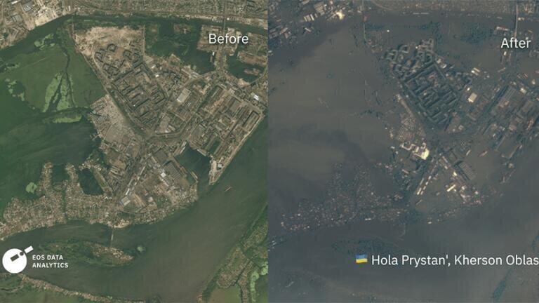
EOS Data Analytics (EOSDA), is a globally renowned provider of AI-powered satellite imagery analytics for agriculture and forestry. They possess satellite photographs of the affected areas both before and after the Kakhovka Dam in Ukraine was destroyed.
It is difficult to comprehend level of damage this event has caused to the environment, but EOSDA’s scientists foresee significant changes in the region's soil, to compound the obvious, immediate effects of this tragedy. Leading scientists, including Yuriy Dmytruk, Doctor of Biological Sciences in Soil Science, and Professor at the Department of Ecology and General Biological Disciplines at Podilskyi State University, Ukraine and EOSDA’s esteemed soil scientist, Vasyl Cherlinka, have worked tirelessly to clarify the situation in the southern Kherson region.
Vasyl Cherlinka stated, "We predict catastrophic changes in the local water cycle for the entire macro-region of South Ukraine solely due to this event. The situation is exacerbated by global warming, which has already led to a shift in natural climatic zones in Ukraine by 150-200 kilometres to the north. In other words, the natural moisture conditions in Zaporizhia, Mykolaiv, and especially Kherson regions already correspond more to the conditions of a Dry Steppe rather than a Steppe, and the lack of water supply for irrigated areas will significantly impact their agricultural potential, water balance, and therefore the moisture cycle.
The Kakhovka Reservoir was the starting point for the Kakhovka Canal, the North Crimean Canal, and the Dnipro-Kryvyi Rih Canal. They served as the foundation for irrigation systems in South Ukraine. Now, all of this infrastructure will cease to function, leading to secondary changes in the soil, such as alterations in salt balance, lowering of groundwater levels, changes in the organic carbon content of soils, and so on.
Due to the destruction, a massive amount of oil from the power plant's turbines spilled into the Dnipro River, with a volume ranging from 150 to 450 tons. This oil will also enter the chernozem (the black soil) and chestnut soils (the dominant soils in the flooded zone). At the same time, a total of 99 populated areas are fully or partially affected.
The scale of destruction and flooding is horrifying, not to mention the potential negative scenarios in case of water shortage for cooling the reactors of the Zaporizhia Nuclear Power Plant. Right now, 18 million cubic meters of water are rushing downstream, destroying everything in its path. The destruction of the GES poses an ecological catastrophe for South Ukraine. The total area that could potentially be covered by water (including the riverbed and mouth of the Dnipro) reaches 1,126 square kilometres."
IET 36.2 Mar/Apr 2026


.jpg)