Water/wastewater
Published over 4 years ago. See the latest and most current information on Water/wastewater.
Water security can be defined as the availability of a sufficient quantity and quality of water to sustain livelihoods, health, socio-economic development and ecosystems. To achieve this goal, water managers need timely access to reliable, insightful, and defensible data.
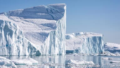
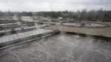
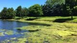
Water resources are under increasing pressure from issues such as climate change, population growth, urbanisation, land use, and agricultural demand. These changes can result in water scarcity (quantity and/or quality) and intensify competition for water resources, so monitoring activities need to adopt a more holistic approach, integrating meteorological, hydrologic, and water quality data throughout an entire catchment.
On a global scale, climate-induced stressors are creating changes to all water resources, like increased average river and stream flows and decreased groundwater reserves. These water conditions can lead to more frequent and severe emergency events like stormwater or flood situations that communities need to prepare for, to ensure the safety of local lives and property. To combat these accelerated environmental changes, organisations are applying for smarter, manageable instruments to monitor water resources that deliver more data, collected more often, with real-time access to information.
The Demand for Hydrology Data is Growing Across the Globe
Whether on the country, city, or municipality level, there is an increasing need to see more detailed information about the water that exists within our communities.
Data is becoming denser and more diverse as new parameters and instruments are added to networks, with data being recorded more frequently. No matter the amount of data being collected, it is crucial to glean insights from that data. Without proper analysis, these utilities are missing out on information that could be critical to understanding the data and completing key tasks such as repairing aging water infrastructure or assessing non-revenue water losses.
Therefore, the first crucial step to smart water data management is utilising the best hardware, including sensors and datalogging tools, for the information that your organisation needs to better conserve and/or adequately manage water, closely followed by having the proper analysis system in place through a robust software to properly view and manage the data.
Setting Up Remote Environmental Monitoring Systems
The purpose of monitoring hardware, including sensors and dataloggers, is to measure and collect data from the field. Every year, technology becomes more advanced with robust capabilities that enhance data collection and validity, with some of the following stand-out trends:
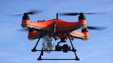
• Non-Contact Sensors: These sensors are growing to be at the height of popularity because they can collect measurements safely above the water to avoid damage by large debris, sediment, and flash floods. Non-contact sensors are ideal for placement on bridges, piers, or mounting arms and above brackish or corrosive conditions.
o Surface water velocity radars have been gaining interest as non-contact options that can collect highly precise velocity measurements in open channels and rivers. These sensors will only continue to grow as a non-contact option over time due to their low power consumption and low maintenance needs.
o Impulse radar technology is a non-contact sensor technology utilised in key monitoring networks around the world to determine water levels in an accurate, energy-efficient way.
• IP Cameras: These are an ideal addition for many application solutions, including flood monitoring, to save employee time and resources. When positioned at a station, they allow you to see your site in near real-time to verify current conditions and determine whether a visit is necessary.
• Increased Data Validation and Flags: Having a remote way to check on equipment in the field is becoming increasingly crucial. Sensors can have built-in status indicators and data quality flags which leverage data from integrated sensors and internal sensor statistics, which all work to ensure data quality.
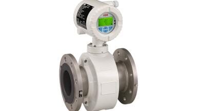
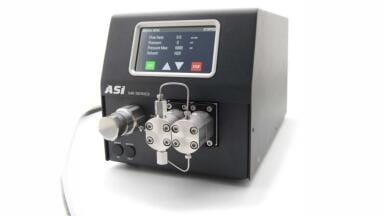
• All-In-One Systems: It’s especially convenient when all required technology for a sensor is included in the device, like for the OTT ecoLog 1000 all-in-one device with the sensor and data logger included.
• Increased Parameters: As organisations move towards data densification, both with data collected more frequently (temporal data) and collected in more locations (spatial data), it’s also helpful to collect increased parameters within water. These can include temperature, conductivity, and other nutrients concerning the quality of water, or surface water velocity and flow concerning the quantity of water.
• Shifts in Datalogging: The emergence of customisation capabilities like Python scripting, as seen in the SUTRON XLink 500 plug and play modems, allow for finetuning based on the exact parameters and frequency of the data collected. Data redundancy also allows for multiple transmissions simultaneously, which is especially helpful during emergency water events where conditions can change rapidly. Real-time spatial and temporal data is important so that flood response resources can be applied effectively. Redundant telemetry systems and redundant hardware at each station help to ensure the provision of reliable data 24/7.
• Shifts in Telemetry Capabilities: As extreme weather events increase due to climate changes, remote data transmissions that are reliable are becoming extremely important. Mobile transmission can be susceptible to inclement weather and bad service, which has led to increased demand for IRIDIUM® and Geostationary Satellites that provide stable and reliable transmissions of data for peace of mind. Transmission options that provide two-way communication are especially valuable as they allow users to check on the status of equipment and send configurations while away from the field.
Managing Remote Environmental Monitoring Systems
The technological challenges of remote data collection have become robust and more comprehensive than ever. As a result, a range of sensors, loggers, power supplies, and telemetry options are available to monitor and manage water data. The potential risk in the ease with which large quantities of remote data can now be gathered automatically is that users may become data rich and information poor. Software that can be quickly and easily configured are now able to provide data solutions that deliver the relevant data, where and when it’s needed most:
• Data Consolidation: Useful for data being collected from multiple sources, especially for complex stations with 3+ telemetry methods needed simultaneously. Third-party data can also be brought into view on the same centralised dashboard to aggregate collected data into one source of truth.
• Data Analysis: To unlock the full value of the collected data from any network size or type, made possible through easy visualisation, scanning, and QA/QC of data with rating curves, automated error detections, and intuitive correction tools that compare historic time-series or discrete data with a defensible audit trail.
• Data Sharing (Internal/External): Provides near real-time alerts, maps, and more to relevant internal and external stakeholders. Data sharing completes the journey of data from sensor to end user, to ensure decisions are made fully informed with the right information.
The advancement of software solutions means that users can be alerted when pre-specified conditions arise – fire, hurricane, heavy rain, etc. It also means that monitoring stations can be visually represented on maps, making it quick and easy to drill down to key data such as the reading from a single water level sensor. For example, water resource managers can integrate environmental data from multiple sources into a single platform like AQUARIUS. This is a toolbox for water managers, allowing them to control the quality of data, build better rating curves, derive statistics, and report in real-time to meet stakeholder expectations for timely, accurate water information. With software, location management is centralized and simplified with easy to search and filter identifiers. Existing systems where other field data exist can be synched for further efficiencies.
Applications in Hydrology Monitoring
Major hydrology monitoring applications include:
• Surface water quantity
o Water level
o Discharge and flow
o Precipitation
o Flood/drought
o Water availability and resource management
• Surface water quality
o Temperature
o Conductivity
o Dissolved Oxygen
• Groundwater
o Water availability
The Importance of Modernisation
As the urgency for collecting and understanding data grows, it’s important to make sure your monitoring network isn’t becoming out-of-date. When equipment becomes older it may become obsolete or unable to configure with a more advanced network or type of technology. Newer equipment like sensors and dataloggers are compatible with advanced technology including multiple telemetry methods which allows you to invest in your collected data for 10-15 years to come. You can ensure your data is high quality to support the crucial decisions you make on a regular basis.
The key to growth is intuitive, easy-to-understand systems that make training straight- forward for teams. By updating your current system, which may have a complicated set-up of many different sondes, sensors, and dataloggers collected over time, you could reduce both time in setting up and the amount of knowledge needed to bring someone to speed on the current network.
Modernised equipment also helps with the total cost of ownership of your network when it comes to lifetime costs and values of your equipment. Total cost of ownership includes the total upfront cost but also cost of maintenance and repairs overtime, the time and money spent on training employees and visiting the field, and the energy needed to learn and understand new systems. An optimised network may cost more upfront but reduce costs, time, and energy rapidly as time goes on.
Modern systems are optimised to be compatible with a greater number of configurations and have more advanced capabilities like python scripting and interchangeable modem cards or more detailed QA/QC information sent remotely from the field.
Turning Data into Decisions
From a global perspective, the purpose of monitoring is to help policy and decision makers at all levels of government to identify challenges and opportunities, set priorities for more effective and efficient implementation, communicate progress (or lack thereof and therefore associated requirements), to ensure accountability, and generate political, public and private sector support for further investments. In this context, the term ‘monitoring’ also includes the gathering of data from regions or organisations, but this article relates specifically to practical environmental monitoring - on the ground and in the field - delivering reliable, granular, defensible data that can be used to underpin the speed and effectivity of important decisions.
From a national perspective, it is vital that baseline data are established so that trends can be monitored and that projection models are based on accurate data. At a local level, it is necessary to understand individual catchments and their interaction with the local environment and communities. Monitoring systems should therefore be capable of detecting trends, measuring the effectiveness of mitigation measures, and providing timely warnings when alarm conditions arise. A holistic approach will be necessary if we are to better understand catchments; this means that groundwater and surface water levels should be correlated with upper catchment monitoring which includes the measurement of meteorological parameters.
Smart water management will ultimately provide transparency into your data to allow you to do more with less: take action quickly, have full insight into your important and timely decisions, have confidence in immediate responses during emergency situations, and automate and optimise your network for easier management. This allows your team to focus on their work rather than manual data collection or entry, to ensure dedication towards forward-looking strategies while your monitoring systems remain efficient and sustainable long-term.
About OTT HydroMet
OTT HydroMet delivers superior customer outcomes by providing decision-makers with vital insights they trust. Our exceptional technical expertise and solutions seamlessly integrate hardware, software, and services across an unmatched range of environmental monitoring applications. We aim to provide expert knowledge in the journey from data to insights, and with leading edge products along the entire data chain.
Get in touch with our team to learn more and easily transform complex data into knowledge.
Resources:
• Thirst for Knowledge eBook
• Managing Data from Field Sensor to Software
• OTT ecolog 1000 Video
• Meet AQUARIUS Video
• SUTRON XLINK 500
• AQUARIUS Software Solution
For more information and to download or view a selection of the above resources, visit otthydromet.com/aquarius or contact [email protected].
IET 36.3 May


.jpg)