Environmental laboratory
Published over 15 years ago. See the latest and most current information on Environmental laboratory.
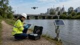
As a result of current legislation and the declaration of Air Quality Management Areas, most Local Authorities are now focusing on the quality of air in their boroughs. In particular, for regions that exceed Government guidelines, Local Authorities have embarked upon detailed monitoring studies by installing a range of instruments to monitor, measure and ultimately help tackle air pollution.
In general, a high percentage of the most serious pollution within most Local Authority boundaries is generated by road traffic. The identification of road generated pollution as a major contributing factor to poor urban air quality has lead to the need for more specific measurement systems to be designed. Many roadside monitors contain analysers which provide continuous measurement of two important urban pollutants: NOx (nitrogen oxides) and PM10 (particulate matter in particles less than 10 microns in aerodynamic diameter), other parameters include NO2 (nitrogen dioxide) CO (carbon monoxide), O3 (ozone), benzene, while also simultaneously measuring noise, temperature and relative humidity.
If levels are found to be high, the Local Authorities can take preventative actions to reduce levels. This additional measurement activity, allied to the fact that it is an undisputed fact that so much urban pollution is road-traffic generated, has led authorities to develop more integrated air pollution management schemes whereby air quality data is integrated into an urban traffic management and control scheme (UTMC). This enables real time data to be used alongside information on roads usage to produce dynamic public information schemes demonstrating the levels of pollution in particular locations. Such information can often lead to modification of traffic flows that will, as a matter of fact, reduce pollution levels.
Software packages collect, analyse and export air quality data to custom designed websites and/or public display screens. This type of service can be used to provide the general public with the latest air quality data and other information or air quality or health related issues from surrounding boroughs.
IET 36.2 Mar/Apr 2026


.jpg)