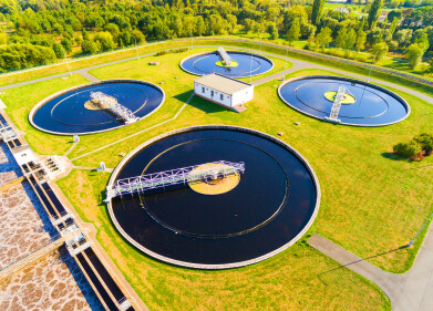
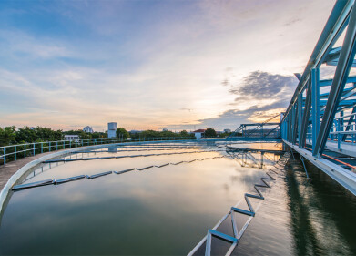
Water/Wastewater
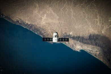
Monitoring California’s Groundwater with Satellites
May 15 2015
The Californian Department of Water Resources has announced plans to use technology developed by NASA to keep track of groundwater levels across the arid state. The system works by monitoring changes in the elevation of the ground above to extrapolate data about water levels below the surface.
Normally, groundwater is monitored purely to assess quality and contamination levels. However, California’s prolonged drought has hit the country’s water supplies so bad that the state are being forced to monitor it – just to make sure it’s still there.
Why the Lack of Groundwater?
Earlier this year, California Governor Jerry Brown imposed statewide limitations on the amount of water deliveries that businesses and homes were allowed to conduct. By reducing delivery rates by 25%, Governor Brown hopes to ease some of the pressure on the outlying reservoirs and rivers which have had to shoulder the burden of California’s ongoing drought.
However, this had led to farmers and municipal water suppliers being caught short on the water they need to stay in operation. To solve the problem, they had resorted to drilling underground and pumping groundwater up to the surface. This is fine in theory… except for a few stumbling blocks, which could have grave consequences for the Californian residents.
Firstly, the water found underground is finite – once it’s gone, it’s gone. This water is used to keep the soil suitable for agriculture and cultivation, not to mention sustaining a whole array of different organisms besides ourselves.
Secondly, and perhaps more immediately concerning from a human perspective, the more water that is sucked from the ground, the lower we sink. This directly affects the infrastructure on the surface of the land, such as bridges, roads, train tracks, buildings and aqueducts, meaning that they collapse in on themselves due to subsidence. Indeed, in the Santa Clara Valley alone, damages due to subsidence are already estimated at a whopping $756 million… and the problem shows no sign of abating.
Satellite Imaging to the Rescue
Though extraction of water from the ground is not allowed, it’s very hard to moderate. Traditional methods such as manually measuring water levels in wells or land surveying techniques are incredibly expensive, time-consuming and not always reliable.
As an alternative, Jessica Reeves and Rosemary Knight, two scientists from Stanford University, decided to apply satellite imaging techniques. This is where signals are beamed down from space to the Earth and then bounced back up to the satellite. The time it takes for it to travel the distance allows the satellite to calculate the position of the ground to within a few centimetres. Since this sort of monitoring has been taking place all over the world for the last few decades, we have a constantly undulating picture of the Earth’s surface.
Of course, the technology needs some fine-tuning to translate Earth movements into groundwater levels, but the basic principle is in place. Knight is confident that the gaps can be bridged and has likened the practice to that of CT scans for humans. “Doctors used to basically have to poke holes in their patient to see if something was wrong,” she said. With this advanced technology from NASA, we might no longer have to poke holes in the surface of the Earth in the form of wells to check if something is wrong with the groundwater.

Digital Edition
IET 34.2 March 2024
April 2024
Gas Detection - Biogas batch fermentation system for laboratory use with automatic gas analysis in real time Water/Wastewater - Upcycling sensors for sustainable nature management - Prist...
View all digital editions


Events
Apr 30 2024 Melbourne, Australia
Apr 30 2024 Birmingham, UK
May 03 2024 Seoul, South Korea
May 05 2024 Seville, Spain
May 06 2024 Minneapolis, MN, USA