Portable/Field Testing
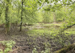
Using UAVs to Improve Flood Risk Management
Dec 01 2015
A twelve month project being undertaken by Cranfield University, which is jointly funded by the Environment Agency and EPSRC (Engineering and Physical Sciences Research Council), is helping to improve the quality of river photography that is used for flood risk management.
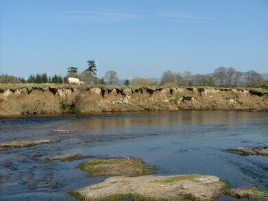
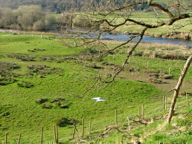
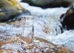
The images provide detailed information to monitor the characteristics of water courses and the effect these have on the surrounding areas. The photographs show details which help to identify areas of erosion or slow moving water and could provide critical data to the Environment Agency to assist in identifying areas of erosion, any places that may require restoration, and areas vulnerable to flooding.
Ben Lukey, a Flood and Coastal Risk Manager at the Environment Agency, said: “We are always investigating new and innovative ways to keep people and properties safe from flooding. Cranfield’s work in developing these UAVs could help complement existing technology like LIDAR to collect the data that practitioners need to manage flood risk effectively.”
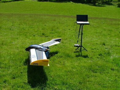
The Cranfield team used camera mounted UAVs (unmanned aerial vehicles) to take detailed photographs, providing a quick and cheap solution to collecting them. Using PC software the pictures are then ‘stitched’ together creating a continual linear view of the river.
Using UAVs to take photographs can result in a skewed distortion of the ground because of the camera’s angle to the ground. Monica Rivas-Casado, a Lecturer in Applied Environmental Statistics who is leading the Cranfield project, came up with a novel ‘ground marker’ to address this problem.
Rivas-Casado said: “In producing the enhanced photography from the UAV the team encountered the issue of ‘roll, pitch and yaw’ from the images, this can distort the pictures as the UAV turns, impacting on the quality of the final pictures or orthomosaic.
“So to counter this, in collaboration with the University of Worcester, we designed a ‘ground marker’ GCP (Ground Control Point). It helps to ‘flatten’ the images when they are processed on the PC, giving an accurate ground image without distortion from the camera on the drone.”
The GCP is a 1 metre white PVC square with opposite facing triangles painted in black to facilitate centroid identification which is pinned to the ground. The black and white markers are then used when producing the final series of photographs to line up the adjacent image.
Unlike an uncorrected aerial photograph, it can be used to measure true distances, because the resulting orthomosiac are an accurate representation of the Earth’s surface and river area and also at a higher resolution - with detail down to 1cm. This provides improved information on vegetation, obstacles, cattle impact, spawning and migration routes for fish. The greater detail also widens the scope and use of the images.
Digital Edition
IET 34.2 March 2024
April 2024
Gas Detection - Biogas batch fermentation system for laboratory use with automatic gas analysis in real time Water/Wastewater - Upcycling sensors for sustainable nature management - Prist...
View all digital editions


Events
Apr 22 2024 Hannover, Germany
Apr 22 2024 Marrakech, Morroco
Apr 23 2024 Kuala Lumpur, Malaysia
Apr 23 2024 Kintex, South Korea
Apr 23 2024 Edmonton, AB, Canada